
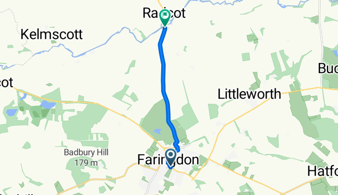
58 Park Road, Faringdon to 2 Radcot Road, Eaton Hastings, Faringdon
A cycling route starting in Faringdon, England, United Kingdom.
Overview
About this route
- 13 min
- Duration
- 4.8 km
- Distance
- 3 m
- Ascent
- 44 m
- Descent
- 23 km/h
- Avg. speed
- ---
- Avg. speed
Route quality
Waytypes & surfaces along the route
Waytypes
Busy road
2.6 km
(54 %)
Quiet road
1.5 km
(31 %)
Surfaces
Paved
1.3 km
(26 %)
Asphalt
1.3 km
(26 %)
Undefined
3.5 km
(74 %)
Continue with Bikemap
Use, edit, or download this cycling route
You would like to ride 58 Park Road, Faringdon to 2 Radcot Road, Eaton Hastings, Faringdon or customize it for your own trip? Here is what you can do with this Bikemap route:
Free features
- Save this route as favorite or in collections
- Copy & plan your own version of this route
- Sync your route with Garmin or Wahoo
Premium features
Free trial for 3 days, or one-time payment. More about Bikemap Premium.
- Navigate this route on iOS & Android
- Export a GPX / KML file of this route
- Create your custom printout (try it for free)
- Download this route for offline navigation
Discover more Premium features.
Get Bikemap PremiumFrom our community
Other popular routes starting in Faringdon
 Office to Office R1
- Distance
- 89 km
- Ascent
- 364 m
- Descent
- 423 m
- Location
- Faringdon, England, United Kingdom
 Red - Swinbrook - Great Rissington - Coln St Aldwyns
- Distance
- 70 km
- Ascent
- 544 m
- Descent
- 543 m
- Location
- Faringdon, England, United Kingdom
 Faringdon 6
- Distance
- 107.4 km
- Ascent
- 233 m
- Descent
- 236 m
- Location
- Faringdon, England, United Kingdom
 Cotswold Meander 2
- Distance
- 64 km
- Ascent
- 345 m
- Descent
- 363 m
- Location
- Faringdon, England, United Kingdom
 Thames Path, Clanfield, Bampton to 104 High St, Burford
- Distance
- 15.1 km
- Ascent
- 92 m
- Descent
- 45 m
- Location
- Faringdon, England, United Kingdom
 Faringdon - Swinbrook - Sherbourne - Coln St Aldwyns
- Distance
- 63.5 km
- Ascent
- 295 m
- Descent
- 311 m
- Location
- Faringdon, England, United Kingdom
 Thrupp
- Distance
- 11.2 km
- Ascent
- 72 m
- Descent
- 71 m
- Location
- Faringdon, England, United Kingdom
 Test route
- Distance
- 35.7 km
- Ascent
- 220 m
- Descent
- 220 m
- Location
- Faringdon, England, United Kingdom
Open it in the app