

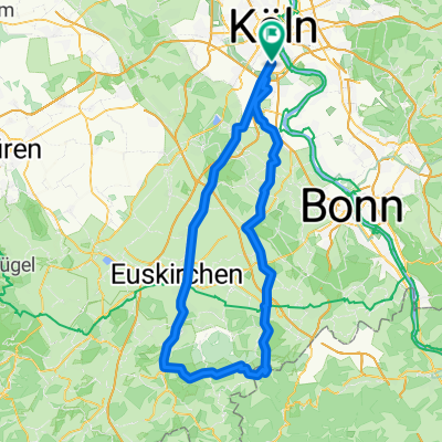
Köln - Luxemburg
A cycling route starting in Bayenthal, North Rhine-Westphalia, Germany.
Overview
About this route
- -:--
- Duration
- 201.5 km
- Distance
- 1,185 m
- Ascent
- 948 m
- Descent
- ---
- Avg. speed
- ---
- Avg. speed

Route quality
Waytypes & surfaces along the route
Waytypes
Busy road
138.7 km
(69 %)
Quiet road
20.3 km
(10 %)
Surfaces
Paved
149.6 km
(74 %)
Unpaved
4.5 km
(2 %)
Asphalt
141.2 km
(70 %)
Gravel
3.3 km
(2 %)
Continue with Bikemap
Use, edit, or download this cycling route
You would like to ride Köln - Luxemburg or customize it for your own trip? Here is what you can do with this Bikemap route:
Free features
- Save this route as favorite or in collections
- Copy & plan your own version of this route
- Sync your route with Garmin or Wahoo
Premium features
Free trial for 3 days, or one-time payment. More about Bikemap Premium.
- Navigate this route on iOS & Android
- Export a GPX / KML file of this route
- Create your custom printout (try it for free)
- Download this route for offline navigation
Discover more Premium features.
Get Bikemap PremiumFrom our community
Other popular routes starting in Bayenthal
 So., 12. 06. 2022
- Distance
- 48.1 km
- Ascent
- 315 m
- Descent
- 315 m
- Location
- Bayenthal, North Rhine-Westphalia, Germany
 Tante Ottos Premiere 04.08.2019
- Distance
- 67.6 km
- Ascent
- 1,414 m
- Descent
- 1,411 m
- Location
- Bayenthal, North Rhine-Westphalia, Germany
 Köln-Dransdorf-Heimerzheim-Brühl-Köln
- Distance
- 79.6 km
- Ascent
- 252 m
- Descent
- 252 m
- Location
- Bayenthal, North Rhine-Westphalia, Germany
 Eifeltour
- Distance
- 106.9 km
- Ascent
- 687 m
- Descent
- 639 m
- Location
- Bayenthal, North Rhine-Westphalia, Germany
 Dubi 19_3
- Distance
- 21 km
- Ascent
- 62 m
- Descent
- 60 m
- Location
- Bayenthal, North Rhine-Westphalia, Germany
 Um die Dhünntalsperre
- Distance
- 91.9 km
- Ascent
- 884 m
- Descent
- 876 m
- Location
- Bayenthal, North Rhine-Westphalia, Germany
 So., 28. 07. 2019
- Distance
- 46.1 km
- Ascent
- 59 m
- Descent
- 59 m
- Location
- Bayenthal, North Rhine-Westphalia, Germany
 Hürth- Kalscheuren
- Distance
- 19.9 km
- Ascent
- 51 m
- Descent
- 51 m
- Location
- Bayenthal, North Rhine-Westphalia, Germany
Open it in the app