

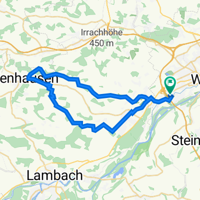
Negrellistraße 17, Gunskirchen nach L549 9
A cycling route starting in Gunskirchen, Upper Austria, Austria.
Overview
About this route
- 3 h 38 min
- Duration
- 60.4 km
- Distance
- 1,447 m
- Ascent
- 1,170 m
- Descent
- 16.7 km/h
- Avg. speed
- ---
- Avg. speed

Route quality
Waytypes & surfaces along the route
Waytypes
Quiet road
36.7 km
(61 %)
Busy road
10.8 km
(18 %)
Surfaces
Paved
11.9 km
(20 %)
Unpaved
0.2 km
(<1 %)
Asphalt
11.9 km
(20 %)
Gravel
0.2 km
(<1 %)
Undefined
48.3 km
(80 %)
Continue with Bikemap
Use, edit, or download this cycling route
You would like to ride Negrellistraße 17, Gunskirchen nach L549 9 or customize it for your own trip? Here is what you can do with this Bikemap route:
Free features
- Save this route as favorite or in collections
- Copy & plan your own version of this route
- Sync your route with Garmin or Wahoo
Premium features
Free trial for 3 days, or one-time payment. More about Bikemap Premium.
- Navigate this route on iOS & Android
- Export a GPX / KML file of this route
- Create your custom printout (try it for free)
- Download this route for offline navigation
Discover more Premium features.
Get Bikemap PremiumFrom our community
Other popular routes starting in Gunskirchen
 Wels West - Pupeter
- Distance
- 29.7 km
- Ascent
- 294 m
- Descent
- 294 m
- Location
- Gunskirchen, Upper Austria, Austria
 Wels-Hudern-Wels
- Distance
- 17.3 km
- Ascent
- 180 m
- Descent
- 182 m
- Location
- Gunskirchen, Upper Austria, Austria
 Wels-StadlPaura-Wimsbach-Wels
- Distance
- 42.6 km
- Ascent
- 252 m
- Descent
- 255 m
- Location
- Gunskirchen, Upper Austria, Austria
 kleine Gunskirchner Runde
- Distance
- 20.8 km
- Ascent
- 156 m
- Descent
- 154 m
- Location
- Gunskirchen, Upper Austria, Austria
 Gunskirchen-Offenhausen-Fernreith
- Distance
- 34.1 km
- Ascent
- 411 m
- Descent
- 411 m
- Location
- Gunskirchen, Upper Austria, Austria
 Wels-Steinerkirchen-Wels
- Distance
- 24.5 km
- Ascent
- 176 m
- Descent
- 174 m
- Location
- Gunskirchen, Upper Austria, Austria
 Wels Gaspaltshofen Lambach Wels
- Distance
- 54.9 km
- Ascent
- 320 m
- Descent
- 323 m
- Location
- Gunskirchen, Upper Austria, Austria
 Wels-Forstberg-Wels
- Distance
- 11.6 km
- Ascent
- 106 m
- Descent
- 104 m
- Location
- Gunskirchen, Upper Austria, Austria
Open it in the app