
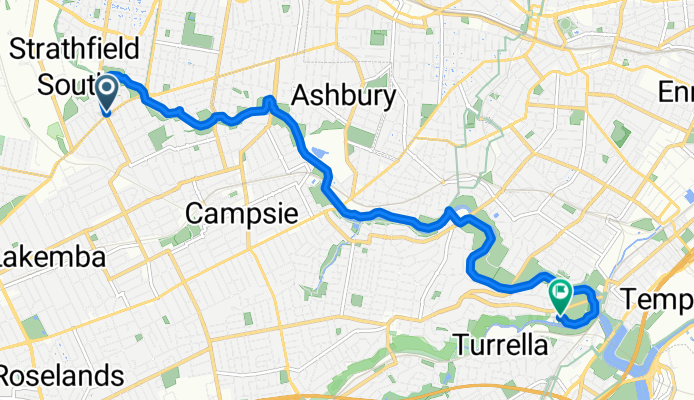
37 Punchbowl Road, Belfield to 2-6 Unwin Street, Earlwood
A cycling route starting in Belfield, New South Wales, Australia.
Overview
About this route
- 33 min
- Duration
- 11 km
- Distance
- 39 m
- Ascent
- 57 m
- Descent
- 20 km/h
- Avg. speed
- ---
- Avg. speed

Continue with Bikemap
Use, edit, or download this cycling route
You would like to ride 37 Punchbowl Road, Belfield to 2-6 Unwin Street, Earlwood or customize it for your own trip? Here is what you can do with this Bikemap route:
Free features
- Save this route as favorite or in collections
- Copy & plan your own version of this route
- Sync your route with Garmin or Wahoo
Premium features
Free trial for 3 days, or one-time payment. More about Bikemap Premium.
- Navigate this route on iOS & Android
- Export a GPX / KML file of this route
- Create your custom printout (try it for free)
- Download this route for offline navigation
Discover more Premium features.
Get Bikemap PremiumFrom our community
Other popular routes starting in Belfield
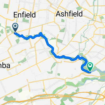 Belfield to Tempe
- Distance
- 7.8 km
- Ascent
- 6 m
- Descent
- 15 m
- Location
- Belfield, New South Wales, Australia
 Burwood Road 241, Belmore to Hospital Road 2A, Concord West
- Distance
- 17.3 km
- Ascent
- 120 m
- Descent
- 123 m
- Location
- Belfield, New South Wales, Australia
 73 Clarence St, Belfield to Strathfield
- Distance
- 4.6 km
- Ascent
- 78 m
- Descent
- 83 m
- Location
- Belfield, New South Wales, Australia
 Croydon Park to Brighton Le-Sands
- Distance
- 17.3 km
- Ascent
- 93 m
- Descent
- 95 m
- Location
- Belfield, New South Wales, Australia
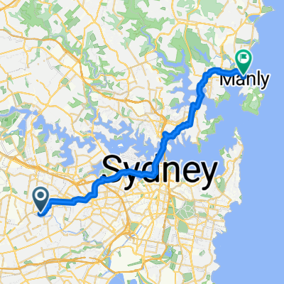 26 Yandarlo Street, Croydon Park to 68–74 North Steyne, Manly
- Distance
- 30 km
- Ascent
- 422 m
- Descent
- 425 m
- Location
- Belfield, New South Wales, Australia
 24 Yandarlo Street, Croydon Park to 24 Yandarlo Street, Croydon Park
- Distance
- 19.8 km
- Ascent
- 0 m
- Descent
- 10 m
- Location
- Belfield, New South Wales, Australia
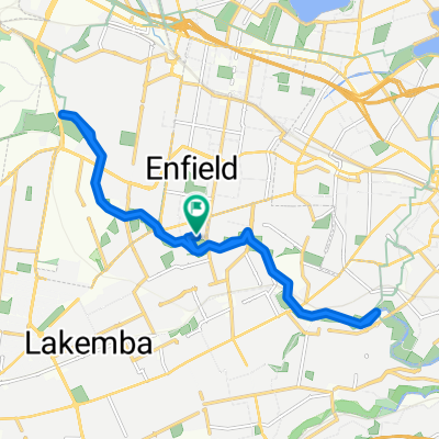
 Water Street 41, Belfield to Queen Street 119, North Strathfield
- Distance
- 7.4 km
- Ascent
- 60 m
- Descent
- 54 m
- Location
- Belfield, New South Wales, Australia
 Trelawney Street 43, Croydon Park to Sanoni Avenue 102, Sandringham
- Distance
- 22.9 km
- Ascent
- 40 m
- Descent
- 70 m
- Location
- Belfield, New South Wales, Australia
Open it in the app