
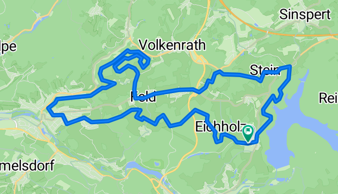
Drei-Bäche-Tour im Oberbergischen Kreis
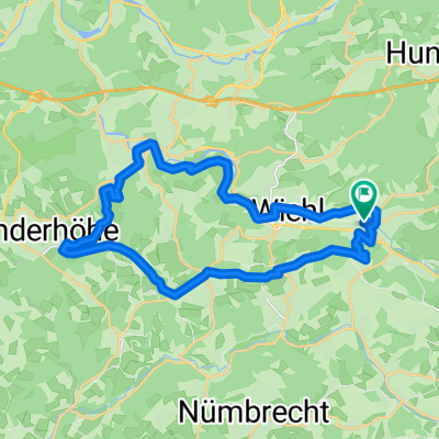
A cycling route starting in Wiehl, North Rhine-Westphalia, Germany.
Overview
About this route
Herbsttour vorbei an folgenden Bächen:
Volkenrather Bach
Heisterbach
Dreisbach
- -:--
- Duration
- 20.8 km
- Distance
- 392 m
- Ascent
- 386 m
- Descent
- ---
- Avg. speed
- 351 m
- Avg. speed
Route quality
Waytypes & surfaces along the route
Waytypes
Track
12.3 km
(59 %)
Quiet road
5.6 km
(27 %)
Surfaces
Paved
4.1 km
(20 %)
Unpaved
11.2 km
(54 %)
Ground
5.2 km
(25 %)
Gravel
5 km
(24 %)
Continue with Bikemap
Use, edit, or download this cycling route
You would like to ride Drei-Bäche-Tour im Oberbergischen Kreis or customize it for your own trip? Here is what you can do with this Bikemap route:
Free features
- Save this route as favorite or in collections
- Copy & plan your own version of this route
- Sync your route with Garmin or Wahoo
Premium features
Free trial for 3 days, or one-time payment. More about Bikemap Premium.
- Navigate this route on iOS & Android
- Export a GPX / KML file of this route
- Create your custom printout (try it for free)
- Download this route for offline navigation
Discover more Premium features.
Get Bikemap PremiumFrom our community
Other popular routes starting in Wiehl
 Oberwiehl-Ruppichteroth-Oberwiehl
- Distance
- 47.4 km
- Ascent
- 471 m
- Descent
- 449 m
- Location
- Wiehl, North Rhine-Westphalia, Germany
 Überschallgeschwindigkeitsfahrt in Reichshof
- Distance
- 14.5 km
- Ascent
- 456 m
- Descent
- 456 m
- Location
- Wiehl, North Rhine-Westphalia, Germany
 Feierabend-Ründchen Oberwiehl - Oberwiehl
- Distance
- 23.7 km
- Ascent
- 304 m
- Descent
- 304 m
- Location
- Wiehl, North Rhine-Westphalia, Germany
 Nach der Arbeit mit Kollegen fahren
- Distance
- 35.9 km
- Ascent
- 558 m
- Descent
- 557 m
- Location
- Wiehl, North Rhine-Westphalia, Germany
 Lengthy ride from Wiehl to Engelskirchen
- Distance
- 46.8 km
- Ascent
- 671 m
- Descent
- 836 m
- Location
- Wiehl, North Rhine-Westphalia, Germany
 Schloss Crottorf
- Distance
- 82.8 km
- Ascent
- 1,270 m
- Descent
- 1,226 m
- Location
- Wiehl, North Rhine-Westphalia, Germany
 Marienhagener Straße 32, Wiehl nach Kirchweg 10, Wiehl
- Distance
- 14.5 km
- Ascent
- 167 m
- Descent
- 204 m
- Location
- Wiehl, North Rhine-Westphalia, Germany
 Ab durch den Wald
- Distance
- 42.9 km
- Ascent
- 913 m
- Descent
- 914 m
- Location
- Wiehl, North Rhine-Westphalia, Germany
Open it in the app