

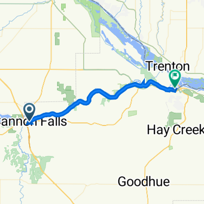
Recovered Route
A cycling route starting in Cannon Falls, Minnesota, United States of America.
Overview
About this route
- 1 h 3 min
- Duration
- 14.8 km
- Distance
- 78 m
- Ascent
- 77 m
- Descent
- 14 km/h
- Avg. speed
- ---
- Avg. speed

Route quality
Waytypes & surfaces along the route
Waytypes
Cycleway
14.8 km
(100 %)
Surfaces
Paved
14.8 km
(100 %)
Asphalt
14.8 km
(100 %)
Continue with Bikemap
Use, edit, or download this cycling route
You would like to ride Recovered Route or customize it for your own trip? Here is what you can do with this Bikemap route:
Free features
- Save this route as favorite or in collections
- Copy & plan your own version of this route
- Sync your route with Garmin or Wahoo
Premium features
Free trial for 3 days, or one-time payment. More about Bikemap Premium.
- Navigate this route on iOS & Android
- Export a GPX / KML file of this route
- Create your custom printout (try it for free)
- Download this route for offline navigation
Discover more Premium features.
Get Bikemap PremiumFrom our community
Other popular routes starting in Cannon Falls
 Welch/Cannon Falls 34mi
- Distance
- 56 km
- Ascent
- 730 m
- Descent
- 737 m
- Location
- Cannon Falls, Minnesota, United States of America
 Recovered Route
- Distance
- 32.7 km
- Ascent
- 421 m
- Descent
- 447 m
- Location
- Cannon Falls, Minnesota, United States of America
 213 Water St W, Cannon Falls to 217 Water St W, Cannon Falls
- Distance
- 48.8 km
- Ascent
- 211 m
- Descent
- 211 m
- Location
- Cannon Falls, Minnesota, United States of America
 Recovered Route
- Distance
- 3.4 km
- Ascent
- 19 m
- Descent
- 10 m
- Location
- Cannon Falls, Minnesota, United States of America
 Easy ride in Welch
- Distance
- 35.3 km
- Ascent
- 461 m
- Descent
- 462 m
- Location
- Cannon Falls, Minnesota, United States of America
 Northstar 2017 Stage 3 Cannon Falls
- Distance
- 95.4 km
- Ascent
- 429 m
- Descent
- 443 m
- Location
- Cannon Falls, Minnesota, United States of America
 4601–4999 Scout Ridge Rd, Cannon Falls to Bay Point Park, Red Wing
- Distance
- 39.4 km
- Ascent
- 333 m
- Descent
- 390 m
- Location
- Cannon Falls, Minnesota, United States of America
 Recovered Route
- Distance
- 35.3 km
- Ascent
- 47 m
- Descent
- 86 m
- Location
- Cannon Falls, Minnesota, United States of America
Open it in the app