

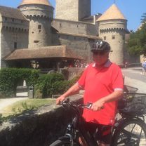
2021 08 20 Binntal
A cycling route starting in Fiesch, Valais, Switzerland.
Overview
About this route
- 6 h 3 min
- Duration
- 44 km
- Distance
- 1,546 m
- Ascent
- 1,535 m
- Descent
- 7.3 km/h
- Avg. speed
- ---
- Avg. speed

Route quality
Waytypes & surfaces along the route
Waytypes
Road
17.3 km
(39 %)
Quiet road
15.6 km
(35 %)
Surfaces
Paved
23.7 km
(54 %)
Unpaved
8.8 km
(20 %)
Asphalt
23.3 km
(53 %)
Gravel
7.4 km
(17 %)
Continue with Bikemap
Use, edit, or download this cycling route
You would like to ride 2021 08 20 Binntal or customize it for your own trip? Here is what you can do with this Bikemap route:
Free features
- Save this route as favorite or in collections
- Copy & plan your own version of this route
- Sync your route with Garmin or Wahoo
Premium features
Free trial for 3 days, or one-time payment. More about Bikemap Premium.
- Navigate this route on iOS & Android
- Export a GPX / KML file of this route
- Create your custom printout (try it for free)
- Download this route for offline navigation
Discover more Premium features.
Get Bikemap PremiumFrom our community
Other popular routes starting in Fiesch
 Gommer Höhenweg 41, Bellwald nach Gommer Höhenweg 40, Bellwald
- Distance
- 19.3 km
- Ascent
- 493 m
- Descent
- 527 m
- Location
- Fiesch, Valais, Switzerland
 Nufenen-Gotthard-Furka
- Distance
- 98.4 km
- Ascent
- 3,250 m
- Descent
- 2,708 m
- Location
- Fiesch, Valais, Switzerland
 coms
coms- Distance
- 35.1 km
- Ascent
- 435 m
- Descent
- 434 m
- Location
- Fiesch, Valais, Switzerland
 Fiesch,Nufenen, Gothard, Furka
- Distance
- 137.7 km
- Ascent
- 3,337 m
- Descent
- 3,343 m
- Location
- Fiesch, Valais, Switzerland
 12,13,14) Nufenen Pass - 2478 m. + Furka Pass – 2429 m. + Grimselpass – 2390 m.
- Distance
- 94.8 km
- Ascent
- 2,799 m
- Descent
- 2,799 m
- Location
- Fiesch, Valais, Switzerland
 2_cesta
- Distance
- 109.3 km
- Ascent
- 743 m
- Descent
- 1,646 m
- Location
- Fiesch, Valais, Switzerland
 2_Gluringen to Saxon
- Distance
- 113 km
- Ascent
- 878 m
- Descent
- 1,781 m
- Location
- Fiesch, Valais, Switzerland
 Alpenbrevet (Variante)
- Distance
- 209.7 km
- Ascent
- 4,645 m
- Descent
- 4,645 m
- Location
- Fiesch, Valais, Switzerland
Open it in the app