
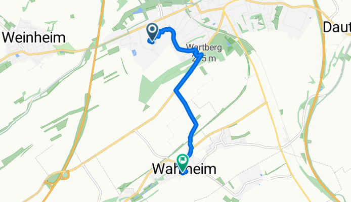
Maximilian-Kolbe-Straße 41, Alzey nach Obergasse 62, Wahlheim
A cycling route starting in Alzey, Rhineland-Palatinate, Germany.
Overview
About this route
- 16 min
- Duration
- 4.1 km
- Distance
- 93 m
- Ascent
- 69 m
- Descent
- 15.7 km/h
- Avg. speed
- 282 m
- Avg. speed
Route quality
Waytypes & surfaces along the route
Waytypes
Busy road
1.2 km
(30 %)
Quiet road
1.1 km
(26 %)
Surfaces
Paved
3.6 km
(88 %)
Unpaved
0.2 km
(4 %)
Asphalt
2.3 km
(57 %)
Paved (undefined)
0.8 km
(18 %)
Continue with Bikemap
Use, edit, or download this cycling route
You would like to ride Maximilian-Kolbe-Straße 41, Alzey nach Obergasse 62, Wahlheim or customize it for your own trip? Here is what you can do with this Bikemap route:
Free features
- Save this route as favorite or in collections
- Copy & plan your own version of this route
- Sync your route with Garmin or Wahoo
Premium features
Free trial for 3 days, or one-time payment. More about Bikemap Premium.
- Navigate this route on iOS & Android
- Export a GPX / KML file of this route
- Create your custom printout (try it for free)
- Download this route for offline navigation
Discover more Premium features.
Get Bikemap PremiumFrom our community
Other popular routes starting in Alzey
 Alzey, Gau-Bickelheim
- Distance
- 53 km
- Ascent
- 758 m
- Descent
- 758 m
- Location
- Alzey, Rhineland-Palatinate, Germany
 Alzey - Eckelsheim - Flonheim
- Distance
- 33 km
- Ascent
- 410 m
- Descent
- 417 m
- Location
- Alzey, Rhineland-Palatinate, Germany
 Alzey-Albig-bechtolsheim-Gau odernheim- Alzey
- Distance
- 21.8 km
- Ascent
- 110 m
- Descent
- 108 m
- Location
- Alzey, Rhineland-Palatinate, Germany
 Alzey-Morschheim-Wahlheim
- Distance
- 21.5 km
- Ascent
- 215 m
- Descent
- 211 m
- Location
- Alzey, Rhineland-Palatinate, Germany
 Alzey-Bechtolsheim-Undenheim-Albig-Alzey
- Distance
- 35.9 km
- Ascent
- 158 m
- Descent
- 184 m
- Location
- Alzey, Rhineland-Palatinate, Germany
 Alzey - Oberwiesen - Nieder-Wiesen - Alzey
- Distance
- 27.7 km
- Ascent
- 289 m
- Descent
- 289 m
- Location
- Alzey, Rhineland-Palatinate, Germany
 Bahnhofstraße 49, Alzey nach Sickingerstraße 6, Alzey
- Distance
- 40.6 km
- Ascent
- 520 m
- Descent
- 522 m
- Location
- Alzey, Rhineland-Palatinate, Germany
 Selztalradweg Alzey bis Nieder-Olm und retour
- Distance
- 58 km
- Ascent
- 354 m
- Descent
- 353 m
- Location
- Alzey, Rhineland-Palatinate, Germany
Open it in the app