

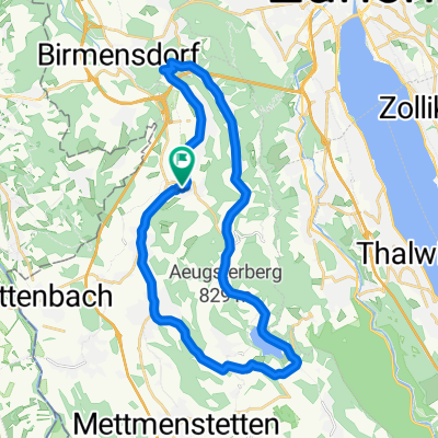
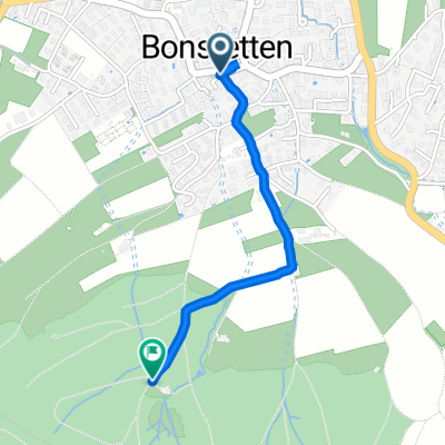
Mick Maus Strecke (für Pingus auch geeigent)
A cycling route starting in Bonstetten, Canton of Zurich, Switzerland.
Overview
About this route
- -:--
- Duration
- 26.7 km
- Distance
- 449 m
- Ascent
- 445 m
- Descent
- ---
- Avg. speed
- ---
- Avg. speed
Route quality
Waytypes & surfaces along the route
Waytypes
Busy road
10.4 km
(39 %)
Road
10.1 km
(38 %)
Surfaces
Paved
19.8 km
(74 %)
Unpaved
0 km
(<1 %)
Asphalt
19.8 km
(74 %)
Gravel
0 km
(<1 %)
Continue with Bikemap
Use, edit, or download this cycling route
You would like to ride Mick Maus Strecke (für Pingus auch geeigent) or customize it for your own trip? Here is what you can do with this Bikemap route:
Free features
- Save this route as favorite or in collections
- Copy & plan your own version of this route
- Sync your route with Garmin or Wahoo
Premium features
Free trial for 3 days, or one-time payment. More about Bikemap Premium.
- Navigate this route on iOS & Android
- Export a GPX / KML file of this route
- Create your custom printout (try it for free)
- Download this route for offline navigation
Discover more Premium features.
Get Bikemap PremiumFrom our community
Other popular routes starting in Bonstetten
 Bonstetten, Aegerisee & retour
- Distance
- 82.8 km
- Ascent
- 914 m
- Descent
- 943 m
- Location
- Bonstetten, Canton of Zurich, Switzerland
 bike tour from Bonstetten to Zürich
- Distance
- 13.7 km
- Ascent
- 134 m
- Descent
- 261 m
- Location
- Bonstetten, Canton of Zurich, Switzerland
 Bonstetten Hedingen Affoltern Zwillinge
- Distance
- 25.5 km
- Ascent
- 415 m
- Descent
- 415 m
- Location
- Bonstetten, Canton of Zurich, Switzerland
 Reppischtal - Türlersee - Wängi
- Distance
- 29.8 km
- Ascent
- 292 m
- Descent
- 292 m
- Location
- Bonstetten, Canton of Zurich, Switzerland
 Reppischtal - Türlersee - Rifferswil CLONED FROM ROUTE 232332
- Distance
- 31.5 km
- Ascent
- 307 m
- Descent
- 304 m
- Location
- Bonstetten, Canton of Zurich, Switzerland
 Am Rainli 2, Bonstetten nach Rehstrasse, Bonstetten
- Distance
- 1.2 km
- Ascent
- 81 m
- Descent
- 18 m
- Location
- Bonstetten, Canton of Zurich, Switzerland
 Albispass und Buchenegg
- Distance
- 16.6 km
- Ascent
- 511 m
- Descent
- 515 m
- Location
- Bonstetten, Canton of Zurich, Switzerland
 Schnelle Radrunde durch Bonstetten
- Distance
- 7.6 km
- Ascent
- 192 m
- Descent
- 192 m
- Location
- Bonstetten, Canton of Zurich, Switzerland
Open it in the app