

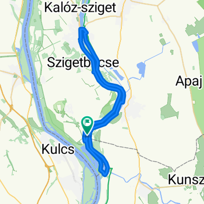
Pentele-kör
A cycling route starting in Rácalmás, Fejér, Hungary.
Overview
About this route
<html />
- -:--
- Duration
- 81.5 km
- Distance
- 180 m
- Ascent
- 180 m
- Descent
- ---
- Avg. speed
- ---
- Avg. speed

Continue with Bikemap
Use, edit, or download this cycling route
You would like to ride Pentele-kör or customize it for your own trip? Here is what you can do with this Bikemap route:
Free features
- Save this route as favorite or in collections
- Copy & plan your own version of this route
- Sync your route with Garmin or Wahoo
Premium features
Free trial for 3 days, or one-time payment. More about Bikemap Premium.
- Navigate this route on iOS & Android
- Export a GPX / KML file of this route
- Create your custom printout (try it for free)
- Download this route for offline navigation
Discover more Premium features.
Get Bikemap PremiumFrom our community
Other popular routes starting in Rácalmás
 Körös Csepel 2
- Distance
- 65.6 km
- Ascent
- 36 m
- Descent
- 18 m
- Location
- Rácalmás, Fejér, Hungary
 Dózsa György utca 10, Kulcs to Dózsa György utca 12, Kulcs
- Distance
- 12.2 km
- Ascent
- 91 m
- Descent
- 96 m
- Location
- Rácalmás, Fejér, Hungary
 Csardas
- Distance
- 13.8 km
- Ascent
- 98 m
- Descent
- 98 m
- Location
- Rácalmás, Fejér, Hungary
 Erdő sor 16., Rácalmás to Erdő sor 16., Rácalmás
- Distance
- 17.9 km
- Ascent
- 119 m
- Descent
- 122 m
- Location
- Rácalmás, Fejér, Hungary
 Erdő sor 16., Rácalmás to Erdő sor 14., Rácalmás
- Distance
- 21.4 km
- Ascent
- 77 m
- Descent
- 77 m
- Location
- Rácalmás, Fejér, Hungary
 RACALMAS-SZEKESFEHERVAR
- Distance
- 71.2 km
- Ascent
- 267 m
- Descent
- 276 m
- Location
- Rácalmás, Fejér, Hungary
 Tassi zsilip - Harta
- Distance
- 47.8 km
- Ascent
- 1,831 m
- Descent
- 1,838 m
- Location
- Rácalmás, Fejér, Hungary
 Kisduna-kör
- Distance
- 40.4 km
- Ascent
- 19 m
- Descent
- 18 m
- Location
- Rácalmás, Fejér, Hungary
Open it in the app