

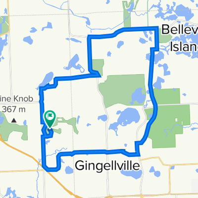
Oakhurst Round Loop
A cycling route starting in Clarkston, Michigan, United States of America.
Overview
About this route
- 41 min
- Duration
- 15.1 km
- Distance
- 10 m
- Ascent
- 4 m
- Descent
- 21.9 km/h
- Avg. speed
- ---
- Avg. speed

Route quality
Waytypes & surfaces along the route
Waytypes
Quiet road
6.8 km
(45 %)
Pedestrian area
3.7 km
(25 %)
Surfaces
Paved
8 km
(53 %)
Unpaved
4.4 km
(29 %)
Asphalt
4.5 km
(30 %)
Unpaved (undefined)
3.8 km
(26 %)
Continue with Bikemap
Use, edit, or download this cycling route
You would like to ride Oakhurst Round Loop or customize it for your own trip? Here is what you can do with this Bikemap route:
Free features
- Save this route as favorite or in collections
- Copy & plan your own version of this route
- Sync your route with Garmin or Wahoo
Premium features
Free trial for 3 days, or one-time payment. More about Bikemap Premium.
- Navigate this route on iOS & Android
- Export a GPX / KML file of this route
- Create your custom printout (try it for free)
- Download this route for offline navigation
Discover more Premium features.
Get Bikemap PremiumFrom our community
Other popular routes starting in Clarkston
 Maybee Rd Polly Ann Indianwood Heahther Lake
- Distance
- 30.2 km
- Ascent
- 163 m
- Descent
- 128 m
- Location
- Clarkston, Michigan, United States of America
 Polly Ann Trail/ Maybee Rd
- Distance
- 24 km
- Ascent
- 14 m
- Descent
- 49 m
- Location
- Clarkston, Michigan, United States of America
 Rhino45
- Distance
- 73.8 km
- Ascent
- 319 m
- Descent
- 319 m
- Location
- Clarkston, Michigan, United States of America
 7556 Olde Sturbridge Trail, Clarkston to 7556 Olde Sturbridge Trail, Clarkston
- Distance
- 12.9 km
- Ascent
- 67 m
- Descent
- 78 m
- Location
- Clarkston, Michigan, United States of America
 Hike-Bike Trail, Clarkston to Indian Trail, Clarkston
- Distance
- 5.8 km
- Ascent
- 88 m
- Descent
- 100 m
- Location
- Clarkston, Michigan, United States of America
 Independence Oaks 7/3
- Distance
- 14.3 km
- Ascent
- 61 m
- Descent
- 63 m
- Location
- Clarkston, Michigan, United States of America
 independance Oaks Park
- Distance
- 25.9 km
- Ascent
- 67 m
- Descent
- 74 m
- Location
- Clarkston, Michigan, United States of America
 Indianwood Polly Ann Trail Maybee Rd
- Distance
- 29.4 km
- Ascent
- 37 m
- Descent
- 11 m
- Location
- Clarkston, Michigan, United States of America
Open it in the app