
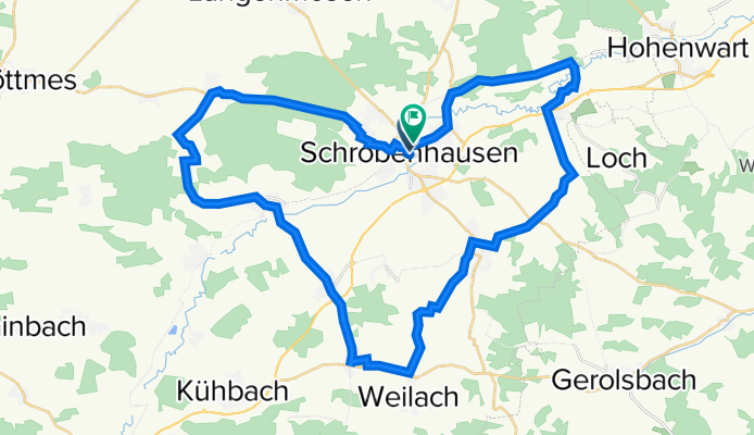
schrobenhausener land
A cycling route starting in Schrobenhausen, Bavaria, Germany.
Overview
About this route
- -:--
- Duration
- 45.7 km
- Distance
- 216 m
- Ascent
- 221 m
- Descent
- ---
- Avg. speed
- 481 m
- Avg. speed
Route quality
Waytypes & surfaces along the route
Waytypes
Quiet road
19.6 km
(43 %)
Path
13.2 km
(29 %)
Surfaces
Paved
38 km
(83 %)
Unpaved
0.7 km
(1 %)
Asphalt
36.2 km
(79 %)
Paved (undefined)
1.6 km
(4 %)
Continue with Bikemap
Use, edit, or download this cycling route
You would like to ride schrobenhausener land or customize it for your own trip? Here is what you can do with this Bikemap route:
Free features
- Save this route as favorite or in collections
- Copy & plan your own version of this route
- Sync your route with Garmin or Wahoo
Premium features
Free trial for 3 days, or one-time payment. More about Bikemap Premium.
- Navigate this route on iOS & Android
- Export a GPX / KML file of this route
- Create your custom printout (try it for free)
- Download this route for offline navigation
Discover more Premium features.
Get Bikemap PremiumFrom our community
Other popular routes starting in Schrobenhausen
 SOB Hörzhausen Goachat
- Distance
- 14 km
- Ascent
- 92 m
- Descent
- 91 m
- Location
- Schrobenhausen, Bavaria, Germany
 009 Altomünster-Gerolsbach-Hohenwart-Hohenried
- Distance
- 77.8 km
- Ascent
- 667 m
- Descent
- 690 m
- Location
- Schrobenhausen, Bavaria, Germany
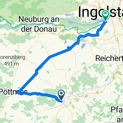 Schrobenhausen_Ingolstadt
- Distance
- 46.9 km
- Ascent
- 40 m
- Descent
- 81 m
- Location
- Schrobenhausen, Bavaria, Germany
 Mariabrunn
- Distance
- 85.2 km
- Ascent
- 794 m
- Descent
- 787 m
- Location
- Schrobenhausen, Bavaria, Germany
 002 Hallertau
- Distance
- 65.8 km
- Ascent
- 453 m
- Descent
- 478 m
- Location
- Schrobenhausen, Bavaria, Germany
 018 SOB-Wolfsberg-Gerolsbach-SOB
- Distance
- 56.2 km
- Ascent
- 341 m
- Descent
- 341 m
- Location
- Schrobenhausen, Bavaria, Germany
 Kaifeckrunde erweitert
- Distance
- 25.5 km
- Ascent
- 104 m
- Descent
- 108 m
- Location
- Schrobenhausen, Bavaria, Germany
 BR Radltour 2013 - Etappe 2 - Schrobenhausen - Manching- Münchsmünster - Kelheim
- Distance
- 80.6 km
- Ascent
- 109 m
- Descent
- 178 m
- Location
- Schrobenhausen, Bavaria, Germany
Open it in the app