

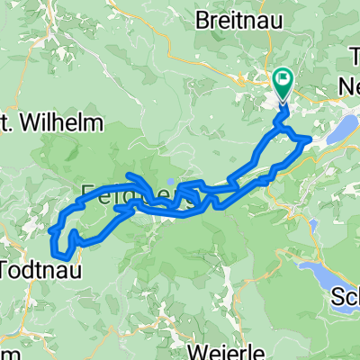
Titisee-Schluchsee-St.Peter-Kandel-Hexenloch-Triberg
A cycling route starting in Hinterzarten, Baden-Württemberg, Germany.
Overview
About this route
- -:--
- Duration
- 117.7 km
- Distance
- 0 m
- Ascent
- 0 m
- Descent
- ---
- Avg. speed
- ---
- Avg. speed
Route quality
Waytypes & surfaces along the route
Waytypes
Busy road
68.3 km
(58 %)
Road
22.4 km
(19 %)
Surfaces
Paved
104.5 km
(89 %)
Unpaved
8.4 km
(7 %)
Asphalt
103.2 km
(88 %)
Ground
3.7 km
(3 %)
Continue with Bikemap
Use, edit, or download this cycling route
You would like to ride Titisee-Schluchsee-St.Peter-Kandel-Hexenloch-Triberg or customize it for your own trip? Here is what you can do with this Bikemap route:
Free features
- Save this route as favorite or in collections
- Copy & plan your own version of this route
- Sync your route with Garmin or Wahoo
Premium features
Free trial for 3 days, or one-time payment. More about Bikemap Premium.
- Navigate this route on iOS & Android
- Export a GPX / KML file of this route
- Create your custom printout (try it for free)
- Download this route for offline navigation
Discover more Premium features.
Get Bikemap PremiumFrom our community
Other popular routes starting in Hinterzarten
 Falkau-Jostal-Thurner-St. Peter-Notschrei-Feldberg-Falkau
- Distance
- 92.9 km
- Ascent
- 1,956 m
- Descent
- 1,913 m
- Location
- Hinterzarten, Baden-Württemberg, Germany
 Feldberg Tour
- Distance
- 54.1 km
- Ascent
- 936 m
- Descent
- 938 m
- Location
- Hinterzarten, Baden-Württemberg, Germany
 Titisee 1
- Distance
- 18.2 km
- Ascent
- 366 m
- Descent
- 366 m
- Location
- Hinterzarten, Baden-Württemberg, Germany
 Radfahren 22.07.2008
- Distance
- 53.2 km
- Ascent
- 713 m
- Descent
- 722 m
- Location
- Hinterzarten, Baden-Württemberg, Germany
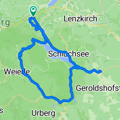
 Titisee - Schluchsee
- Distance
- 46.1 km
- Ascent
- 1,002 m
- Descent
- 1,019 m
- Location
- Hinterzarten, Baden-Württemberg, Germany
 Black Forest Ultra Bike 42km
- Distance
- 40.1 km
- Ascent
- 753 m
- Descent
- 1,290 m
- Location
- Hinterzarten, Baden-Württemberg, Germany
 Radfahren 24.07.2008
- Distance
- 105.5 km
- Ascent
- 1,548 m
- Descent
- 1,552 m
- Location
- Hinterzarten, Baden-Württemberg, Germany
 Rund um den Feldberg ...
- Distance
- 47.2 km
- Ascent
- 1,274 m
- Descent
- 1,273 m
- Location
- Hinterzarten, Baden-Württemberg, Germany
Open it in the app