Cycling Route in Witten, North Rhine-Westphalia, Germany
Rheinischer Esel-Wannebachtal-Hengstey-und Harkort See- Witten
0
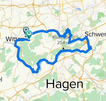
Open this route in Bikemap Web
49
km
Distance
Distance
298
m
Ascent
Ascent
249
m
Descent
Descent
3:17
h
Duration
Duration
15.6
km/h
Avg. Speed
Avg. Speed
235
m
Max. Elevation
Max. Elevation