


20.3.2026 Burgenzauber
- 46.9 km
- 729 m
- 780 m
- Binningen, Basel-Landschaft, Switzerland

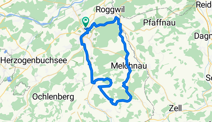
Cycling route in Langenthal, Canton of Bern, Switzerland
Cycling route in Langenthal, Canton of Bern, Switzerland
Cycling route in Prad am Stilfser Joch, Trentino-Alto Adige, Italy
Cycling route in Langenthal, Canton of Bern, Switzerland


