

Thomas St
- Time on Bikemap
- Member since 7/8/2009
My routes
Planned and recorded rides


Collections and multi-stage tours
 Collection
Discover
My most popular routes


Hoch und runter im Emmental und Napfgebiet
Cycling route in Wynigen, Canton of Bern, Switzerland
Ein dauerndes hoch und runter auf wenig befahrenden Strassen im Napfgebiet. Optimales Intervalltraining.
- 108.6 km
- Distance
- 981 m
- Ascent
- 983 m
- Descent
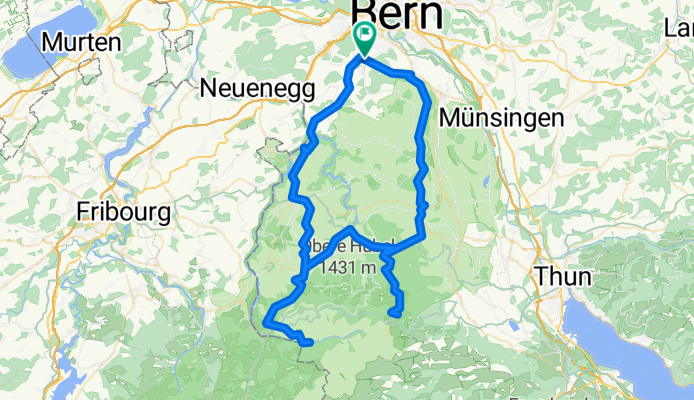
Gurnigel-Runde
Cycling route in Köniz, Canton of Bern, Switzerland
Varied landscape, beautiful climbs, optimal training ride
- 97.1 km
- Distance
- 2,864 m
- Ascent
- 2,807 m
- Descent

Mont Ventoux ab Bédoin
Cycling route in Mormoiron, Provence-Alpes-Côte d'Azur Region, France
- 48.4 km
- Distance
- 1,645 m
- Ascent
- 1,646 m
- Descent