Sul sentiero di Papa Giovanni XXIII°
A cycling route starting in Bergamo, Lombardy, Italy.
Overview
About this route
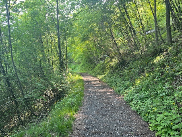
Arrivati a Sotto il Monte seguiamo le frecce bianche e rosse JXXIII che per 15 km tra sterrati e sentieri, aggirando a mezza costa il Monte Canto, ci conducono dapprima a Pontida, e poi su per i boschi di Celana fino alla Chiesa di San Gregorio dove termina il sentiero. La pedalabilità che fino a Pontida è del 100%, diminuisce al 90% nei boschi di Celana e sull'ultimo tratto, quello che sale a San Gregorio, si spinge a mano.
- -:--
- Duration
- 51.5 km
- Distance
- 495 m
- Ascent
- 496 m
- Descent
- ---
- Avg. speed
- ---
- Avg. speed
Continue with Bikemap
Use, edit, or download this cycling route
You would like to ride Sul sentiero di Papa Giovanni XXIII° or customize it for your own trip? Here is what you can do with this Bikemap route:
Free features
- Save this route as favorite or in collections
- Copy & plan your own version of this route
- Sync your route with Garmin or Wahoo
Premium features
Free trial for 3 days, or one-time payment. More about Bikemap Premium.
- Navigate this route on iOS & Android
- Export a GPX / KML file of this route
- Create your custom printout (try it for free)
- Download this route for offline navigation
Discover more Premium features.
Get Bikemap PremiumFrom our community
Other popular routes starting in Bergamo
 Baite Ducone - Lerano
- Distance
- 69.3 km
- Ascent
- 667 m
- Descent
- 667 m
- Location
- Bergamo, Lombardy, Italy
 Baite dei Mùch
- Distance
- 54.7 km
- Ascent
- 1,204 m
- Descent
- 1,203 m
- Location
- Bergamo, Lombardy, Italy
 Allenamento... fangoso
- Distance
- 17.9 km
- Ascent
- 450 m
- Descent
- 404 m
- Location
- Bergamo, Lombardy, Italy
 Monasterolo- Buca del Corno- Grena di Zandobbio
- Distance
- 61.6 km
- Ascent
- 686 m
- Descent
- 686 m
- Location
- Bergamo, Lombardy, Italy
 Ciclopedonale dei Boschi e dei Fontanili
- Distance
- 45.3 km
- Ascent
- 114 m
- Descent
- 96 m
- Location
- Bergamo, Lombardy, Italy
 Giro della Val de Grù
- Distance
- 59 km
- Ascent
- 927 m
- Descent
- 931 m
- Location
- Bergamo, Lombardy, Italy
 Sentieri tra Bergamo e Ranica
- Distance
- 21.5 km
- Ascent
- 255 m
- Descent
- 255 m
- Location
- Bergamo, Lombardy, Italy
 Lengthy bike tour through Monasterolo del Castello
- Distance
- 31 km
- Ascent
- 172 m
- Descent
- 80 m
- Location
- Bergamo, Lombardy, Italy
Open it in the app


