
Reichenau-Schwarzenbach (Jachau) (36,1 km)
A cycling route starting in Lenggries, Bavaria, Germany.
Overview
About this route
nass war's Ich bin die Route in umgekehrter Richtung geradelt, diese erscheint mir aber günstiger. Der Trail ab Tanneralm ist radlbar, über die Bäche muss man ev rüberheben, je nach Mut. Der Wanderweg ab/an der oberen Orterer Alm ist aber definitiv nicht radlbar, d.h. "übel schieben". Bei Almbetrieb ist ev kein Zugang möglich. Der Weg über die Rautalm dürfte also die bessere Variante sein. Trotz "nur" ca 800 Hm sind die Steigungen heftig. Die Schluchten sind der Hingucker, das Panorama von der Tanneralm aber auch. Nicht viel "Verkehr" da oben.
- -:--
- Duration
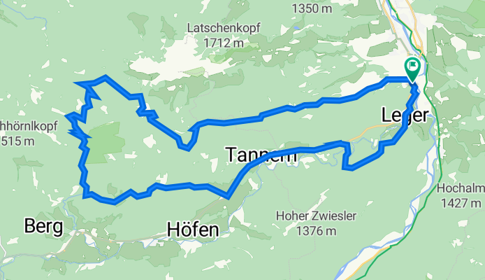
- 35.5 km
- Distance
- 1,154 m
- Ascent
- 1,153 m
- Descent
- ---
- Avg. speed
- 1,319 m
- Avg. speed

Route photos
 (36,1 km)\"")
 (36,1 km)\"")
 (36,1 km)\"")
 (36,1 km)\"")
 (36,1 km)\"")
 (36,1 km)\"")
Continue with Bikemap
Use, edit, or download this cycling route
You would like to ride Reichenau-Schwarzenbach (Jachau) (36,1 km) or customize it for your own trip? Here is what you can do with this Bikemap route:
Free features
- Save this route as favorite or in collections
- Copy & plan your own version of this route
- Sync your route with Garmin or Wahoo
Premium features
Free trial for 3 days, or one-time payment. More about Bikemap Premium.
- Navigate this route on iOS & Android
- Export a GPX / KML file of this route
- Create your custom printout (try it for free)
- Download this route for offline navigation
Discover more Premium features.
Get Bikemap PremiumFrom our community
Other popular routes starting in Lenggries
 Um den Walchensee 65-400
- Distance
- 65.1 km
- Ascent
- 994 m
- Descent
- 1,013 m
- Location
- Lenggries, Bavaria, Germany
 leichte Sylvensteinrunde
- Distance
- 122.2 km
- Ascent
- 1,474 m
- Descent
- 1,433 m
- Location
- Lenggries, Bavaria, Germany
 leichter Downhill von der Lenggrieser Hütte zum Spitzingsee (Albert Link Hütte)
- Distance
- 36.5 km
- Ascent
- 588 m
- Descent
- 892 m
- Location
- Lenggries, Bavaria, Germany
 Tour 27 Wild Wild West
- Distance
- 46.9 km
- Ascent
- 1,191 m
- Descent
- 1,191 m
- Location
- Lenggries, Bavaria, Germany
 Lenggries - Lenggrieser Hütte
- Distance
- 12.1 km
- Ascent
- 762 m
- Descent
- 99 m
- Location
- Lenggries, Bavaria, Germany
 Von Lenggries auf den Brauneck
- Distance
- 14.2 km
- Ascent
- 816 m
- Descent
- 813 m
- Location
- Lenggries, Bavaria, Germany
 Lenggries - Seekarkreuz -Schwarze Tenn - Glashütte - Lenggries
- Distance
- 36 km
- Ascent
- 1,180 m
- Descent
- 1,180 m
- Location
- Lenggries, Bavaria, Germany
 RW 43km Fleck - Puppling
- Distance
- 43.2 km
- Ascent
- 225 m
- Descent
- 336 m
- Location
- Lenggries, Bavaria, Germany
Open it in the app