
My saved routes
A collection of 5 cycling routes, created by hugocc.
Overview
About this collection
This collection contains all routes that were previously saved.
- 5
- Routes
- -:--
- Duration
- 293.9 km
- Distance
- ---
- Avg. speed
- 2,089 m
- Ascent
- 1,949 m
- Descent
hugocc

created this 9 years ago
My saved routes
Routes in this collection
All 5 routes in this collection can be opened on the map or in the Bikemap App for more details, where you can adjust them in the route planner, or download them as GPX or KML file. Use them as a template for planning your own rides, or let Bikemap navigate you along them directly.

枋寮-墾丁‧一日海景
枋寮train station
Launch in 楓港
Noon: 恆春古城與龍巒潭
Sunset: 墾丁
- 61.4 km
- Distance
- 149 m
- Ascent
- 139 m
- Descent

墾丁-龍磐-社頂‧一日風景路線
Cycling route in Hengchun, Taiwan, Taiwan
墾丁大街出發,往東志龍磐,至龍仔埔草原小路,上社頂公園回
- 24.4 km
- Distance
- 308 m
- Ascent
- 212 m
- Descent

大里-基隆‧東北角海岸一日風景
Morning: 大里train station -> 三貂角燈塔
Launch in 福隆 beach
Noon: 龍洞、鼻頭角、陰陽海
Afternoon: 基隆 train station
- 62.7 km
- Distance
- 261 m
- Ascent
- 276 m
- Descent
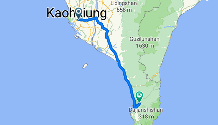
高雄-四重溪
Cycling route in Kaohsiung City, Kaohsiung, Taiwan
Meeting at Gaoping Bridge
County Road 189 to resupply in Chaozhou
Provincial Highway 1 via Fangliao to meeting point in Fenggang
In Checheng, turn east onto County Road 199
- 94.8 km
- Distance
- 148 m
- Ascent
- 103 m
- Descent

北宜石深路線
Cycling route in Banqiao District, Taipei, Taiwan
南勢角=> 碧潭 => 北宜 => 石碇 => 深坑 => 木柵 => 景美 => 秀朗橋 => 南勢角
- 50.7 km
- Distance
- 1,223 m
- Ascent
- 1,219 m
- Descent