
My saved routes
A collection of 7 cycling routes, created by seitenstecher.
Overview
About this collection
This collection contains all routes that were previously saved.
- 7
- Routes
- -:--
- Duration
- 987.6 km
- Distance
- ---
- Avg. speed
- 5,462 m
- Ascent
- 5,841 m
- Descent

created this 9 years ago
My saved routes
Routes in this collection
All 7 routes in this collection can be opened on the map or in the Bikemap App for more details, where you can adjust them in the route planner, or download them as GPX or KML file. Use them as a template for planning your own rides, or let Bikemap navigate you along them directly.

Raben-Toten-Hohen-stein-Runde
Cycling route in Chemnitz, Saxony, Germany
- 41.4 km
- Distance
- 393 m
- Ascent
- 397 m
- Descent
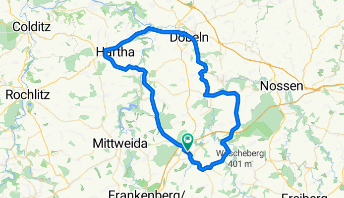
Trainigstour HC-DL CLONED FROM ROUTE 621876
Cycling route in Hainichen, Saxony, Germany
- 68.4 km
- Distance
- 485 m
- Ascent
- 485 m
- Descent
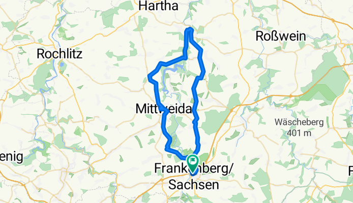
Speeders Day 09 Frankenberg-Frankenberg
Cycling route in Frankenberg, Saxony, Germany
- 48.6 km
- Distance
- 405 m
- Ascent
- 405 m
- Descent

Chemnitz-Fichtelberg-Chemnitz
Cycling route in Chemnitz, Saxony, Germany
- 144.3 km
- Distance
- 1,500 m
- Ascent
- 1,500 m
- Descent

Chemnitz Fichtelberg
Cycling route in Chemnitz, Saxony, Germany
- 136.9 km
- Distance
- 1,539 m
- Ascent
- 1,541 m
- Descent

Rabenstein-Oberwald-Wolkenburg-Lunzenau-Burgstädt
Cycling route in Wittgensdorf, Saxony, Germany
- 87.8 km
- Distance
- 806 m
- Ascent
- 843 m
- Descent

Chemnitz-Koserow
Cycling route in Hilbersdorf, Saxony, Germany
- 460.4 km
- Distance
- 334 m
- Ascent
- 670 m
- Descent