
My saved routes
A collection of 12 cycling routes, created by Petr Liška.
Overview
About this collection
This collection contains all routes that were previously saved.
- 12
- Routes
- -:--
- Duration
- 476.5 km
- Distance
- ---
- Avg. speed
- 2,667 m
- Ascent
- 2,650 m
- Descent

created this 9 years ago
My saved routes
Routes in this collection
All 12 routes in this collection can be opened on the map or in the Bikemap App for more details, where you can adjust them in the route planner, or download them as GPX or KML file. Use them as a template for planning your own rides, or let Bikemap navigate you along them directly.

Trasa podél řeky Opavice
- 10.2 km
- Distance
- 21 m
- Ascent
- 21 m
- Descent

Běchovice - Dolní/Horní Počernice - Klánovice - Úvaly - Újezd CLONED FROM ROUTE 363907
Cycling route in Šestajovice, Central Bohemia, Czechia
- 28.2 km
- Distance
- 159 m
- Ascent
- 159 m
- Descent
![Na oběd (Selský statek - Újezd) [real]](https://media.bikemap.net/routes/666777/staticmaps/in_e4c60798-0804-49c9-bd06-09edf3aff054_694x400_bikemap-2021-3D-static.png)
Na oběd (Selský statek - Újezd) [real]
Cycling route in Horní Počernice, Prague, Czechia
- 37.4 km
- Distance
- 208 m
- Ascent
- 198 m
- Descent

Z Počernic k Hostivařské přehradě
Cycling route in Horní Počernice, Prague, Czechia
- 36.7 km
- Distance
- 230 m
- Ascent
- 230 m
- Descent

Č. Most (metro) - Kyje - Počernice - Klánovice - Č. Most
Cycling route in Černý Most, Prague, Czechia
- 32 km
- Distance
- 175 m
- Ascent
- 178 m
- Descent

Vinné tour 2006 1.den
Cycling route in Mikulov, South Moravian, Czechia
- 62.9 km
- Distance
- 366 m
- Ascent
- 366 m
- Descent

Okolo Mikulova 1
Cycling route in Mikulov, South Moravian, Czechia
- 30.7 km
- Distance
- 359 m
- Ascent
- 382 m
- Descent

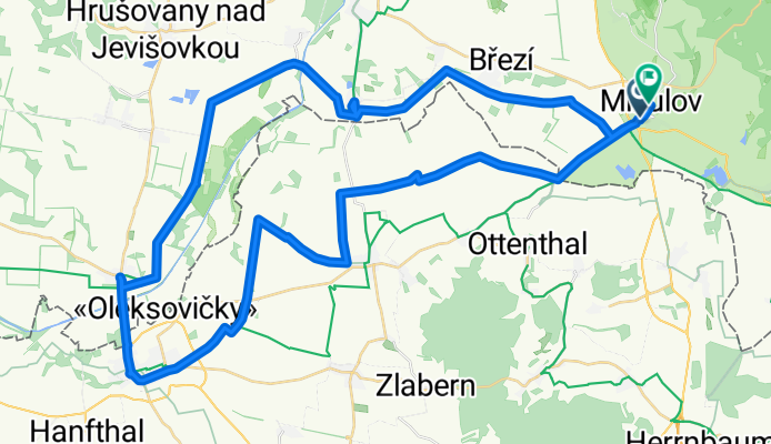
Mikulov3
Cycling route in Mikulov, South Moravian, Czechia
- 47.7 km
- Distance
- 234 m
- Ascent
- 234 m
- Descent
Mikulov - Laa - Mikulov
Cycling route in Mikulov, South Moravian, Czechia
- 59.6 km
- Distance
- 167 m
- Ascent
- 127 m
- Descent

Mik-Lednice
Cycling route in Mikulov, South Moravian, Czechia
- 46.3 km
- Distance
- 236 m
- Ascent
- 241 m
- Descent

CM - Hovorcovice - Roztoky - Troja - Vysocany - CM
Cycling route in Černý Most, Prague, Czechia
- 46.4 km
- Distance
- 241 m
- Ascent
- 242 m
- Descent

39 km po pražských cyklostezkách
Cycling route in Horní Počernice, Prague, Czechia
- 38.4 km
- Distance
- 271 m
- Ascent
- 272 m
- Descent