
My saved routes
A collection of 19 cycling routes, created by Kerstin Schlarb.
Overview
About this collection
This collection contains all routes that were previously saved.
- 19
- Routes
- -:--
- Duration
- 1,914 km
- Distance
- ---
- Avg. speed
- 16,872 m
- Ascent
- 16,772 m
- Descent
created this 9 years ago
My saved routes
Routes in this collection
All 19 routes in this collection can be opened on the map or in the Bikemap App for more details, where you can adjust them in the route planner, or download them as GPX or KML file. Use them as a template for planning your own rides, or let Bikemap navigate you along them directly.

Grundlage flach
Cycling route in Ingelheim, Rhineland-Palatinate, Germany
- 138.4 km
- Distance
- 47 m
- Ascent
- 47 m
- Descent

Sonntag 29. Sep
Cycling route in Gau-Algesheim, Rhineland-Palatinate, Germany
- 94.8 km
- Distance
- 591 m
- Ascent
- 588 m
- Descent

Malle_2013_Tag_05
Cycling route in Santa Margalida, Balearic Islands, Spain
- 105.9 km
- Distance
- 770 m
- Ascent
- 770 m
- Descent
Malle_2013_Tag_08
Cycling route in es Camp de Mar, Balearic Islands, Spain
- 127.5 km
- Distance
- 2,196 m
- Ascent
- 2,185 m
- Descent

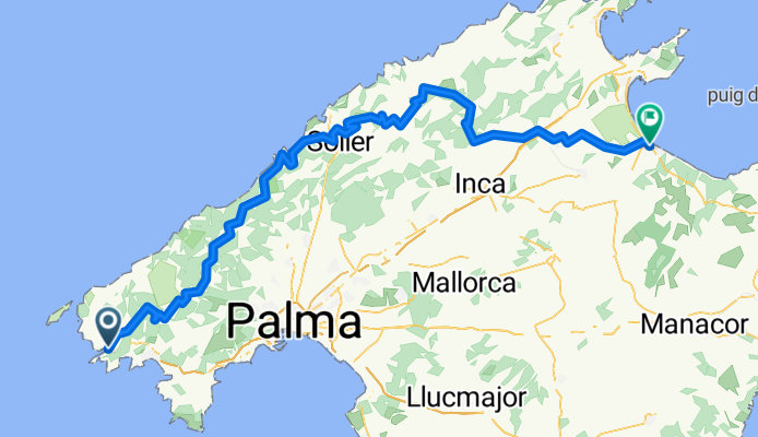
08.04.2014 Sa Calobra
Cycling route in Santa Margalida, Balearic Islands, Spain
- 126.1 km
- Distance
- 1,528 m
- Ascent
- 1,528 m
- Descent

ZZ_2015_Malle_Tour_6_Simsalabim
Cycling route in Santa Margalida, Balearic Islands, Spain
- 133.6 km
- Distance
- 1,539 m
- Ascent
- 1,539 m
- Descent

ZZ_2015_Malle_Randa_Neu
Cycling route in Santa Margalida, Balearic Islands, Spain
- 115.9 km
- Distance
- 767 m
- Ascent
- 767 m
- Descent

MTB Tour Laubenheimer Höhe
Cycling route in Oestrich-Winkel, Rhineland-Palatinate, Germany
- 59.2 km
- Distance
- 245 m
- Ascent
- 246 m
- Descent

Marienthal-Lorch-Marienthal
Cycling route in Geisenheim, Hesse, Germany
- 46.7 km
- Distance
- 953 m
- Ascent
- 955 m
- Descent

123123
Cycling route in Schriesheim, Baden-Wurttemberg, Germany
- 29.3 km
- Distance
- 805 m
- Ascent
- 805 m
- Descent

Ingelheim-Feldberg 02.08.2014
Cycling route in Oestrich-Winkel, Rhineland-Palatinate, Germany
- 155.6 km
- Distance
- 1,327 m
- Ascent
- 1,322 m
- Descent

Ingelheim - Guldental - Wallhausen - Mandel - Waldböckelheim - Odernheim - Bad Münster - Fürfeld - Sprendlingen - Ingelheim
Cycling route in Ingelheim, Rhineland-Palatinate, Germany
- 118.1 km
- Distance
- 878 m
- Ascent
- 876 m
- Descent