
My saved routes
A collection of 11 cycling routes, created by hamsterpdim.
Overview
About this collection
This collection contains all routes that were previously saved.
- 11
- Routes
- -:--
- Duration
- 483.6 km
- Distance
- ---
- Avg. speed
- 5,341 m
- Ascent
- 5,221 m
- Descent
created this 9 years ago
My saved routes
Routes in this collection
All 11 routes in this collection can be opened on the map or in the Bikemap App for more details, where you can adjust them in the route planner, or download them as GPX or KML file. Use them as a template for planning your own rides, or let Bikemap navigate you along them directly.

Waldenbuch Filderstadt Aichtal Siebenmuellen
Cycling route in Leinfelden-Echterdingen, Baden-Wurttemberg, Germany
- 45.3 km
- Distance
- 377 m
- Ascent
- 391 m
- Descent

Esslingen - Remseck - Runde
Cycling route in Esslingen am Neckar, Baden-Wurttemberg, Germany
- 45.9 km
- Distance
- 538 m
- Ascent
- 498 m
- Descent

Kleines Bergtraining
Cycling route in Kornwestheim, Baden-Wurttemberg, Germany
- 27.2 km
- Distance
- 313 m
- Ascent
- 333 m
- Descent

kurze Hausrunde
Cycling route in Leinfelden-Echterdingen, Baden-Wurttemberg, Germany
- 44 km
- Distance
- 328 m
- Ascent
- 328 m
- Descent

Heimsheim
Cycling route in Stuttgart, Baden-Wurttemberg, Germany
- 30.6 km
- Distance
- 395 m
- Ascent
- 278 m
- Descent

Neu-Ulm - Kuhberg - Blaubeuren - Asch RR
Cycling route in Ulm, Baden-Wurttemberg, Germany
- 58.7 km
- Distance
- 713 m
- Ascent
- 713 m
- Descent

Blaustein_Lonsee_Blaustein
Cycling route in Dornstadt, Baden-Wurttemberg, Germany
- 45.8 km
- Distance
- 448 m
- Ascent
- 444 m
- Descent

Unisport 21.03.12
Cycling route in Stuttgart, Baden-Wurttemberg, Germany
- 52.7 km
- Distance
- 634 m
- Ascent
- 640 m
- Descent

2009-06-18 MTB
Cycling route in Leinfelden-Echterdingen, Baden-Wurttemberg, Germany
- 35.4 km
- Distance
- 529 m
- Ascent
- 529 m
- Descent
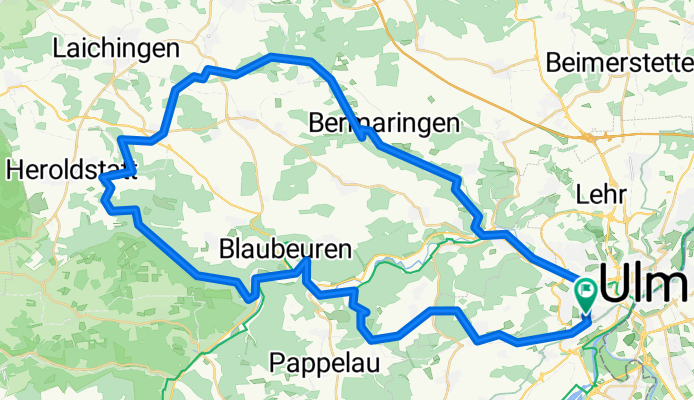
Sontheimer Höhle
Cycling route in Ulm, Baden-Wurttemberg, Germany
- 68.7 km
- Distance
- 604 m
- Ascent
- 604 m
- Descent

Bisschen Quer Feld ein
Cycling route in Ulm, Baden-Wurttemberg, Germany
- 29.2 km
- Distance
- 462 m
- Ascent
- 463 m
- Descent