
My saved routes
A collection of 13 cycling routes, created by Holger Lornsen.OverviewAbout this collection
This collection contains all routes that were previously saved.
- 13
- Routes
- -:--
- Duration
- 847.4 km
- Distance
- ---
- Avg. speed
- 10,563 m
- Ascent
- 9,018 m
- Descent
Holger Lornsencreated this 9 years ago

Route des Crêtes (Massif des Maures-83)
Cycling route in Le Lavandou, Provence-Alpes-Côte d'Azur Region, France
Du niveau de la mer au Col du Canadel à 444 mètres. Prévoir 3 heures pour une quarantaine de kilomètres au compteur .
- 41.5 km
- Distance
- 666 m
- Ascent
- 671 m
- Descent

Kleine Stramplerei Pfalz
Cycling route in Wachenheim, Rhineland-Palatinate, Germany
- 77.3 km
- Distance
- 369 m
- Ascent
- 370 m
- Descent

Edingen-MA-Kalmit-Speyer-Edingen
Cycling route in Edingen-Neckarhausen, Baden-Wurttemberg, Germany
- 123.7 km
- Distance
- 581 m
- Ascent
- 583 m
- Descent
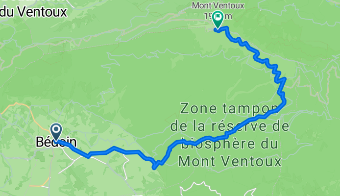
Mont Ventoux Bedoin
Cycling route in Bédoin, Provence-Alpes-Côte d'Azur Region, France
- 21.3 km
- Distance
- 1,583 m
- Ascent
- 0 m
- Descent

giro con mogliettina.....
Cycling route in Spinea, Veneto, Italy
campagne e fiumi
- 73.4 km
- Distance
- 25 m
- Ascent
- 27 m
- Descent

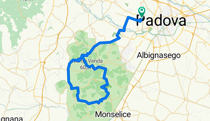
Gita più bella nei Colli
Cycling route in Padua, Veneto, Italy
Gita pazzesca
- 104.7 km
- Distance
- 1,360 m
- Ascent
- 1,362 m
- Descent

Arsiè M.te Grappa Bassano Arsiè
Cycling route in Arsiè, Veneto, Italy
- 91.6 km
- Distance
- 2,174 m
- Ascent
- 2,194 m
- Descent

Östringen-Östringen
Cycling route in Östringen, Baden-Wurttemberg, Germany
Test-Tour Kraichgau
- 42.6 km
- Distance
- 480 m
- Ascent
- 480 m
- Descent

Allenamento Granfondo
Cycling route in Padua, Veneto, Italy
Half Gran Fondo Training 2011
- 59 km
- Distance
- 638 m
- Ascent
- 641 m
- Descent
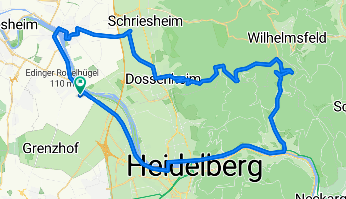
Edingen - Weißer Stein - Edingen
Cycling route in Edingen-Neckarhausen, Baden-Wurttemberg, Germany
From halfway to the white stone down to the road to Ziegelhausen, the asphalt gets worse, so it’s better to go via Dossenheim...
- 40.2 km
- Distance
- 486 m
- Ascent
- 486 m
- Descent

Edingen-Weißer Stein-Königsstuhl-Edingen
Cycling route in Edingen-Neckarhausen, Baden-Wurttemberg, Germany
...
- 56.6 km
- Distance
- 936 m
- Ascent
- 936 m
- Descent