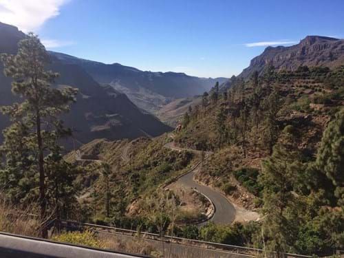
Gran Canaria - south
A collection of 4 cycling routes, created by Spies/Ving.
Overview
About this collection
0
Gran Canaria is perfect for both relaxing in the sun and climbing steep mountains on your bike. Routes here are challenging with long climbs. Often not very long distance to water/food along the route.
- 4
- Routes
- -:--
- Duration
- 405.1 km
- Distance
- ---
- Avg. speed
- 6,710 m
- Ascent
- 6,672 m
- Descent
Spies/Ving
created this 9 years ago
Gran Canaria - south
Routes in this collection
All 4 routes in this collection can be opened on the map or in the Bikemap App for more details, where you can adjust them in the route planner, or download them as GPX or KML file. Use them as a template for planning your own rides, or let Bikemap navigate you along them directly.

Arguineguin - Soira - Mogan (use boat)
Starting flat, getting steep up to Soira and then the last climb will take your breath away before entering the nice and long descent to Puerto de Mogan.
Very steep (first part up to 15% - from Soira up it will be up to 25%).
Cafes in Soira and Mogan
- 61.8 km
- Distance
- 988 m
- Ascent
- 997 m
- Descent


Puerto Rico - Arguineguin - Maspalomas - Fataga - Mogan
Cycling route in Puerto Rico, Canary Islands, Spain
(OBS! Use boat from Mogan to Puerto Rico due to road block) Great route with sights and plenty of cafés. Pavement is great in the climbing part but first part of the decent is not so good. Last part of descent to Mogan is really great.
- 96 km
- Distance
- 1,546 m
- Ascent
- 1,507 m
- Descent

Puerto Rico - Playa del Inglés - Vecindario - Santa Lucia - Fataga
Great for those who want to try a steep mountain pass. Great descent through the Fataga valley.
- 110.3 km
- Distance
- 1,212 m
- Ascent
- 1,205 m
- Descent

South coast - Mogan - Anagua - San Bartolomé - Fatata - Maspalomas
Cycling route in Maspalomas, Canary Islands, Spain
Climbers delight with a guarantee of suffering. Use all day for this stage, and book a nice massage in your hotel upon return.
Note: The road down to Soira is pretty bad. So take it easy and very slow. We changed the route due to closed sea side road near Puerto de Mogan
- 137 km
- Distance
- 2,964 m
- Ascent
- 2,963 m
- Descent