
My saved routes
A collection of 6 cycling routes, created by nilsd.
Overview
About this collection
This collection contains all routes that were previously saved.
- 6
- Routes
- -:--
- Duration
- 1,947.5 km
- Distance
- ---
- Avg. speed
- 26,171 m
- Ascent
- 30,053 m
- Descent
nilsd
created this 9 years ago
My saved routes
Routes in this collection
All 6 routes in this collection can be opened on the map or in the Bikemap App for more details, where you can adjust them in the route planner, or download them as GPX or KML file. Use them as a template for planning your own rides, or let Bikemap navigate you along them directly.
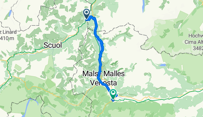
4 Etappe - Alternative zu Sesvenna - Martinsbruck - Prad
Cycling route in Nauders, Tyrol, Austria
Martinsbruck (Martina) - Nauders - Reschenpass - Reschen - Graun - Laatsch - Glurns - Prad
- 46.6 km
- Distance
- 568 m
- Ascent
- 684 m
- Descent

BIKE Transalp 2010 Etappe1-8 CLONED FROM ROUTE 617480
Cycling route in Füssen, Bavaria, Germany
- 535.4 km
- Distance
- 10,762 m
- Ascent
- 11,491 m
- Descent

Füssen-Gardasee 2012
Cycling route in Füssen, Bavaria, Germany
- 358.1 km
- Distance
- 5,059 m
- Ascent
- 5,777 m
- Descent

Transalp Ehrwald- Riva del Garda
Cycling route in Ehrwald, Tyrol, Austria
Tach zusammen, für alle die die eine recht einfache Route über die Alpen suchen, kann ich Euch diese hier empfehlen. Ihr müsst mit ca. 450km rechnen und fahrt über den Reschenpass, Reschensee im Inntal durch das Etschtral durch herrliche Apfel- und Weintraubenanbaugebiete. Ich würde sagen, dass sic…
- 296.3 km
- Distance
- 1,402 m
- Ascent
- 2,342 m
- Descent

Von Garmisch zum Gardasee
Cycling route in Grainau, Bavaria, Germany
Transalp von Garmisch nach Torbole (Gardasee) in 350 km und 7,000 hm.
Tour führt über Ehrwald, Fernpass, Imst, Landeck, Nauders, Reschenpass, Meran, Gampenpass, Cles, Molveno See.
Vom Schwierigkeitsgrad ist es eine einfache Alpenüberquerung mit dem Mountainbike.
- 346 km
- Distance
- 3,628 m
- Ascent
- 4,315 m
- Descent

Transalp Garmisch - Riva
Cycling route in Grainau, Bavaria, Germany
- 365 km
- Distance
- 4,752 m
- Ascent
- 5,444 m
- Descent