
Latscher Sonnen-Nördersberg Trails
A collection of 11 cycling routes, created by Thomas Sch..
Overview
About this collection
Trails around Laces
- 11
- Routes
- -:--
- Duration
- 129.2 km
- Distance
- ---
- Avg. speed
- 11,973 m
- Ascent
- 349 m
- Descent

created this 8 years ago
Latscher Sonnen-Nördersberg Trails
Routes in this collection
All 11 routes in this collection can be opened on the map or in the Bikemap App for more details, where you can adjust them in the route planner, or download them as GPX or KML file. Use them as a template for planning your own rides, or let Bikemap navigate you along them directly.

Uphill Latscher Alm
Cycling route in Latsch, Trentino-Alto Adige, Italy
- 14.2 km
- Distance
- 1,104 m
- Ascent
- 51 m
- Descent

Uphill Marzoner Alm 1
Cycling route in Castelbello-Ciardes - Kastelbell-Tschars, Trentino-Alto Adige, Italy
- 10.4 km
- Distance
- 1,025 m
- Ascent
- 7 m
- Descent

Uphill Marzoner Alm 2
Cycling route in Castelbello, Trentino-Alto Adige, Italy
- 11.9 km
- Distance
- 1,099 m
- Ascent
- 65 m
- Descent

Uphill Morterer Leger
Cycling route in Latsch, Trentino-Alto Adige, Italy
- 8.6 km
- Distance
- 982 m
- Ascent
- 4 m
- Descent
Uphill Schloss-Annenberg
Cycling route in Latsch, Trentino-Alto Adige, Italy
- 13.8 km
- Distance
- 1,125 m
- Ascent
- 34 m
- Descent

Uphill Tablander Alm
Cycling route in Castelbello, Trentino-Alto Adige, Italy
- 13.5 km
- Distance
- 1,218 m
- Ascent
- 14 m
- Descent

Uphill Tarscher Alm
Cycling route in Latsch, Trentino-Alto Adige, Italy
- 9.4 km
- Distance
- 1,107 m
- Ascent
- 0 m
- Descent

Uphill Propain Trail
Cycling route in Latsch, Trentino-Alto Adige, Italy
- 9.2 km
- Distance
- 767 m
- Ascent
- 20 m
- Descent

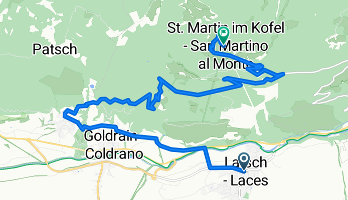
Uphill St. Martin - Fora Hoefe
Cycling route in Castelbello-Ciardes - Kastelbell-Tschars, Trentino-Alto Adige, Italy
- 14 km
- Distance
- 1,186 m
- Ascent
- 87 m
- Descent
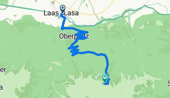
Uphill Goeflaner Marmorbruch
Cycling route in Laas, Trentino-Alto Adige, Italy
- 13.7 km
- Distance
- 1,283 m
- Ascent
- 11 m
- Descent

Uphill Freiberger Mahd
Cycling route in Latsch, Trentino-Alto Adige, Italy
- 10.5 km
- Distance
- 1,077 m
- Ascent
- 56 m
- Descent