
My saved routes
A collection of 14 cycling routes, created by Alpha Joe.
Overview
About this collection
This collection contains all routes that were previously saved.
- 14
- Routes
- -:--
- Duration
- 1,621.3 km
- Distance
- ---
- Avg. speed
- 19,932 m
- Ascent
- 17,781 m
- Descent
created this 9 years ago
My saved routes
Routes in this collection
All 14 routes in this collection can be opened on the map or in the Bikemap App for more details, where you can adjust them in the route planner, or download them as GPX or KML file. Use them as a template for planning your own rides, or let Bikemap navigate you along them directly.


Ironman 70.3. Wiesbaden
Cycling route in Walluf, Hesse, Germany
- 89.9 km
- Distance
- 1,537 m
- Ascent
- 1,298 m
- Descent

Frankfurt-City-Triathlon Radstrecke Olympisch
Cycling route in Mörfelden-Walldorf, Hesse, Germany
- 45.1 km
- Distance
- 61 m
- Ascent
- 59 m
- Descent

3-Länder-Tour
Cycling route in Frankfurt am Main, Hesse, Germany
- 247.9 km
- Distance
- 2,964 m
- Ascent
- 2,926 m
- Descent

Taunusrunde (joebuck)
Cycling route in Frankfurt am Main, Hesse, Germany
- 147.9 km
- Distance
- 2,259 m
- Ascent
- 2,060 m
- Descent
FFM Hoherodskopf Wächtersbach
Cycling route in Frankfurt am Main, Hesse, Germany
- 152.5 km
- Distance
- 1,518 m
- Ascent
- 1,300 m
- Descent

innsbruck-praxmar-grinzens-mutters-innsbruck
Cycling route in Innsbruck, Tyrol, Austria
- 70.3 km
- Distance
- 1,589 m
- Ascent
- 1,517 m
- Descent

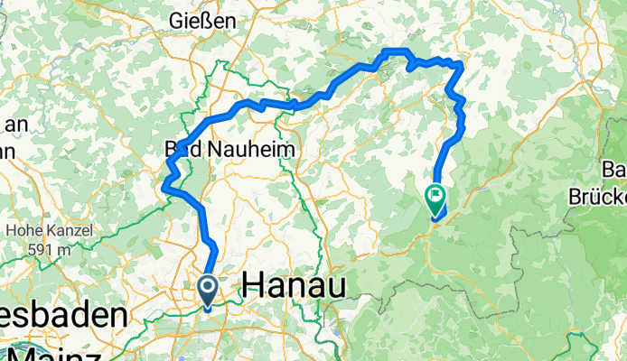
hanau - wasserkuppe
Cycling route in Hanau, Hesse, Germany
- 142.9 km
- Distance
- 1,969 m
- Ascent
- 1,545 m
- Descent

2009-07-14 - Bolzano - Bolzano
Cycling route in Cardano, Trentino-Alto Adige, Italy
- 64.6 km
- Distance
- 2,286 m
- Ascent
- 2,100 m
- Descent

bozen-runde
Cycling route in Bolzano, Trentino-Alto Adige, Italy
- 26.8 km
- Distance
- 1,126 m
- Ascent
- 1,124 m
- Descent

Bozen - Ritten - Lengstein - Barbian - Bozen (Rennrad)
Cycling route in Bolzano, Trentino-Alto Adige, Italy
- 54.4 km
- Distance
- 1,448 m
- Ascent
- 1,446 m
- Descent

Hessischer Radfernweg R1
Cycling route in Bad Hersfeld, Hesse, Germany
- 110.4 km
- Distance
- 776 m
- Ascent
- 521 m
- Descent