
Deutschlandtour 2018
A cycling tour with 12 stages, starting in Söhlde, Lower Saxony, Germany.
Overview
About this tour
This cycling tour has 12 stages and a total length of 1,043 km.
- 12
- Routes
- -:--
- Duration
- 1,043 km
- Distance
- ---
- Avg. speed
- 5,493 m
- Ascent
- 5,182 m
- Descent

Deutschlandtour 2018
Stages of this tour
All 12 stages of this tour can be opened on the map or in the Bikemap App for more details, where you can adjust them in the route planner or download them as GPX or KML file. Use them as a template for planning your own tour, or let Bikemap navigate you along them directly.

01. Söhlde - Walkenried
Cycling route in Söhlde, Lower Saxony, Germany
- 102.9 km
- Distance
- 879 m
- Ascent
- 702 m
- Descent

02. Walkenried - Witzenhausen
Cycling route in Walkenried, Lower Saxony, Germany
- 78.4 km
- Distance
- 632 m
- Ascent
- 761 m
- Descent

03. Witzenhausen - Tann
Cycling route in Witzenhausen, Hesse, Germany
- 113.9 km
- Distance
- 540 m
- Ascent
- 302 m
- Descent

04. Tann - Hildburghausen
Cycling route in Tann, Hesse, Germany
- 73.6 km
- Distance
- 682 m
- Ascent
- 682 m
- Descent

05 Hildburghausen - Wirsberg
Cycling route in Hildburghausen, Thuringia, Germany
- 93.6 km
- Distance
- 325 m
- Ascent
- 344 m
- Descent

06 Wirsberg - Weiden in der Oberpfalz
Cycling route in Wirsberg, Bavaria, Germany
- 79.7 km
- Distance
- 468 m
- Ascent
- 431 m
- Descent
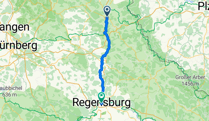
07. Weiden i. d. Oberpfalz - Regensburg
Cycling route in Weiden, Bavaria, Germany
- 89.2 km
- Distance
- 156 m
- Ascent
- 207 m
- Descent

08. Regensburg - Pfaffenhofen a. d. Ilm
Cycling route in Regensburg, Bavaria, Germany
- 89.6 km
- Distance
- 220 m
- Ascent
- 130 m
- Descent

09. Pfaffenhofen - Dießen am Ammersee
Cycling route in Pfaffenhofen an der Ilm, Bavaria, Germany
- 88.6 km
- Distance
- 267 m
- Ascent
- 164 m
- Descent

10 Dießen am Ammersee - Füssen im Allgäu
Cycling route in Dießen am Ammersee, Bavaria, Germany
- 67.2 km
- Distance
- 515 m
- Ascent
- 260 m
- Descent

11. Füssen im Allgäu - Lindau am Bodensee
Cycling route in Füssen, Bavaria, Germany
- 94 km
- Distance
- 688 m
- Ascent
- 1,087 m
- Descent

12. Lindau - Öhningen
Cycling route in Lindau, Bavaria, Germany
- 72.2 km
- Distance
- 121 m
- Ascent
- 112 m
- Descent