
Deidesheim
A collection of 9 cycling routes, created by tattig.
Overview
About this collection
This route collection contains 9 cycling routes with a total length of 265 km.
- 9
- Routes
- -:--
- Duration
- 265 km
- Distance
- ---
- Avg. speed
- 6,093 m
- Ascent
- 5,727 m
- Descent

created this 7 years ago
Deidesheim
Routes in this collection
All 9 routes in this collection can be opened on the map or in the Bikemap App for more details, where you can adjust them in the route planner, or download them as GPX or KML file. Use them as a template for planning your own rides, or let Bikemap navigate you along them directly.

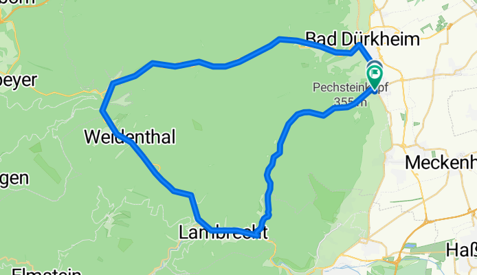
Pfalzblick-Eckkopf-Staben-Königsbach
Cycling route in Deidesheim, Rhineland-Palatinate, Germany
- 16.9 km
- Distance
- 451 m
- Ascent
- 411 m
- Descent

Trail-Tour Deidesheim-Hadenburg-Wachenheim
Cycling route in Deidesheim, Rhineland-Palatinate, Germany
- 34.6 km
- Distance
- 995 m
- Ascent
- 965 m
- Descent

Von Deidesheim zum Lambertskreuz auf Trails
Cycling route in Deidesheim, Rhineland-Palatinate, Germany
- 21 km
- Distance
- 781 m
- Ascent
- 426 m
- Descent

Deidesheim --> Wachenheim
Cycling route in Deidesheim, Rhineland-Palatinate, Germany
- 13.5 km
- Distance
- 365 m
- Ascent
- 403 m
- Descent

Mußbach-Weinbiet-Totenkopfhütte-Mußbach
Cycling route in Neustadt an der Weinstraße, Rhineland-Palatinate, Germany
- 44.8 km
- Distance
- 873 m
- Ascent
- 873 m
- Descent
it schönen blick
Cycling route in Wachenheim, Rhineland-Palatinate, Germany
- 41.7 km
- Distance
- 817 m
- Ascent
- 819 m
- Descent


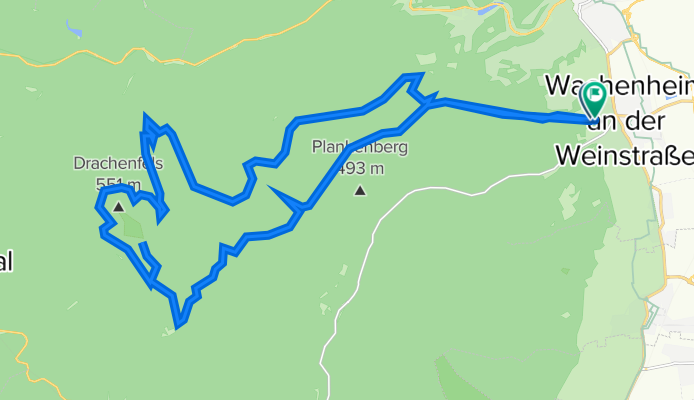
Wachenheim-Lambi-Eckkopf-Wachenburg-Hexenstein 30km 700hm
Cycling route in Wachenheim, Rhineland-Palatinate, Germany
- 30.1 km
- Distance
- 683 m
- Ascent
- 689 m
- Descent

Wachenheim-Lambertskreuz
Cycling route in Wachenheim, Rhineland-Palatinate, Germany
- 30.2 km
- Distance
- 533 m
- Ascent
- 533 m
- Descent
Poppental Saupferch Drachenfels Lambertskreuz
Cycling route in Wachenheim, Rhineland-Palatinate, Germany
- 32.2 km
- Distance
- 595 m
- Ascent
- 608 m
- Descent