
My saved routes
A collection of 7 cycling routes, created by Christopher.
Overview
About this collection
This collection contains all routes that were previously saved.
- 7
- Routes
- -:--
- Duration
- 225.3 km
- Distance
- ---
- Avg. speed
- 3,845 m
- Ascent
- 3,908 m
- Descent
created this 10 years ago
My saved routes
Routes in this collection
All 7 routes in this collection can be opened on the map or in the Bikemap App for more details, where you can adjust them in the route planner, or download them as GPX or KML file. Use them as a template for planning your own rides, or let Bikemap navigate you along them directly.
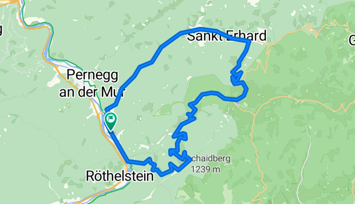
ALPENTOUR-DRACHENTOUR
Cycling route in Röthelstein, Styria, Austria
- 42 km
- Distance
- 1,161 m
- Ascent
- 1,161 m
- Descent

Mountainbikestrecke Hiaslegg
Cycling route in Niklasdorf, Styria, Austria
- 63.3 km
- Distance
- 661 m
- Ascent
- 661 m
- Descent
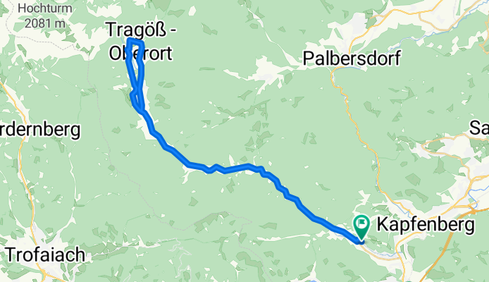
Tragößer Radtour
Cycling route in Bruck an der Mur, Styria, Austria
- 41.3 km
- Distance
- 366 m
- Ascent
- 366 m
- Descent

Weyer Panoramaroute
Cycling route in Weyer, Upper Austria, Austria
- 26 km
- Distance
- 808 m
- Ascent
- 807 m
- Descent

Bad Hall - Steyr (Schwarze Brücke)
Cycling route in Bad Hall, Upper Austria, Austria
- 23.7 km
- Distance
- 175 m
- Ascent
- 239 m
- Descent

Bad Hall Rundstrecke
Cycling route in Bad Hall, Upper Austria, Austria
- 9.4 km
- Distance
- 137 m
- Ascent
- 137 m
- Descent

Kleinraming - Kohlergraben - Schwarzberg
Cycling route in Behamberg, Lower Austria, Austria
- 19.5 km
- Distance
- 537 m
- Ascent
- 537 m
- Descent