
geplant MTB
A collection of 9 cycling routes, created by Andreas Thiede.
Overview
About this collection
This route collection contains 9 cycling routes with a total length of 348.3 km.
- 9
- Routes
- -:--
- Duration
- 348.3 km
- Distance
- ---
- Avg. speed
- 7,188 m
- Ascent
- 7,093 m
- Descent
created this 7 years ago
geplant MTB
Routes in this collection
All 9 routes in this collection can be opened on the map or in the Bikemap App for more details, where you can adjust them in the route planner, or download them as GPX or KML file. Use them as a template for planning your own rides, or let Bikemap navigate you along them directly.
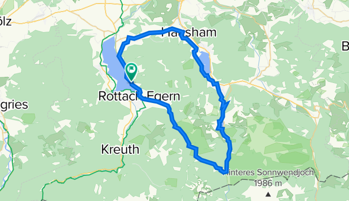
Tegernsee, Valepp, Spitzingsee, Schliersee
Cycling route in Tegernsee, Bavaria, Germany
- 47.5 km
- Distance
- 623 m
- Ascent
- 625 m
- Descent

Valepp Kaiserklam EHJ
Cycling route in Bayrischzell, Bavaria, Germany
- 47 km
- Distance
- 1,019 m
- Ascent
- 1,031 m
- Descent

Rund um die Rotwand
Cycling route in Fischbachau, Bavaria, Germany
- 39.4 km
- Distance
- 703 m
- Ascent
- 695 m
- Descent

Valepp-Runde
Cycling route in Schliersee, Bavaria, Germany
- 34.5 km
- Distance
- 979 m
- Ascent
- 870 m
- Descent
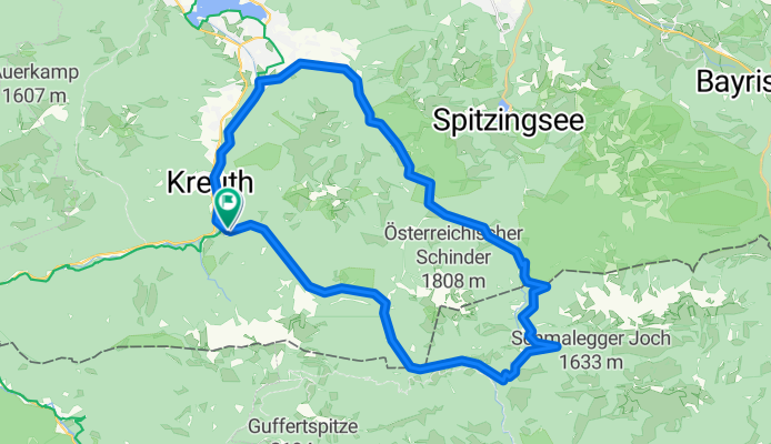
Große Runde Am Tegernsee über Erzherzog-Johann-Klause CLONED FROM ROUTE 213010
Cycling route in Kreuth, Bavaria, Germany
- 43.8 km
- Distance
- 773 m
- Ascent
- 779 m
- Descent

Wandbergalm im Inntal
Cycling route in Rettenschöss, Tyrol, Austria
- 31.5 km
- Distance
- 974 m
- Ascent
- 974 m
- Descent

Rundweg 59
Cycling route in Hausham, Bavaria, Germany
- 48.4 km
- Distance
- 668 m
- Ascent
- 669 m
- Descent

Spitzingsee nach Enterrottach über die Almen
Cycling route in Fischbachau, Bavaria, Germany
- 28.4 km
- Distance
- 765 m
- Ascent
- 764 m
- Descent

Bad Tölz - Rechelkopf - Schwaiger-Alm - Gaißach - Bad Tölz
Cycling route in Bad Tölz, Bavaria, Germany
- 27.9 km
- Distance
- 684 m
- Ascent
- 686 m
- Descent