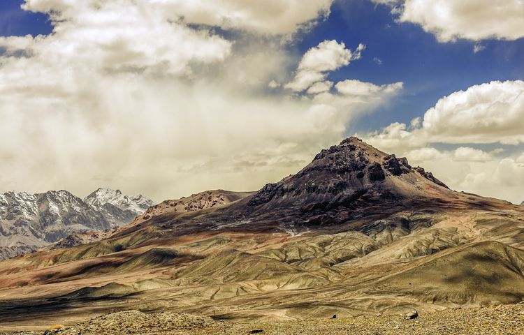
M41 - Pamir Highway (via Wakhan)
A collection of 15 cycling routes, created by juergen jakobitsch.
Overview
About this collection
Daily distances for M41 (pamir highway) via wakhan valley
- 15
- Routes
- -:--
- Duration
- 1,172.5 km
- Distance
- ---
- Avg. speed
- 10,593 m
- Ascent
- 11,271 m
- Descent

created this 7 years ago
M41 - Pamir Highway (via Wakhan)
Routes in this collection
All 15 routes in this collection can be opened on the map or in the Bikemap App for more details, where you can adjust them in the route planner, or download them as GPX or KML file. Use them as a template for planning your own rides, or let Bikemap navigate you along them directly.


M41 - Day 02 - Vanj Valley - Rushon
Cycling route in Vanj, Gorno-Badakhshan, Tajikistan
- 90.5 km
- Distance
- 888 m
- Ascent
- 430 m
- Descent

M41 - Day 0 - Tavildara - Kalaikhum
- 76.6 km
- Distance
- 1,726 m
- Ascent
- 2,083 m
- Descent


M41 - Day 01 - Kalaikhum - Vanj Valley
Cycling route in Qalaikhumb, Gorno-Badakhshan, Tajikistan
- 85.1 km
- Distance
- 651 m
- Ascent
- 373 m
- Descent

M41 - Day 04 - Khorog - Eshkashim
Cycling route in Khorugh, Gorno-Badakhshan, Tajikistan
- 104.2 km
- Distance
- 743 m
- Ascent
- 285 m
- Descent

M41 - Day 05 - Eshkashim - Yamchun
Cycling route in Ishqoshim, Gorno-Badakhshan, Tajikistan
- 71.3 km
- Distance
- 653 m
- Ascent
- 459 m
- Descent

M41 - Day 06 - Yamchun - Langar
Cycling route in Khandūd, Badakhshan, Afghanistan
- 39.6 km
- Distance
- 241 m
- Ascent
- 181 m
- Descent

M41 - Day 03 - Rushon - Khorog
Cycling route in Rŭshon, Gorno-Badakhshan, Tajikistan
- 63.4 km
- Distance
- 253 m
- Ascent
- 164 m
- Descent

M41 - Day 10 - Murghab - Ak Baital
Cycling route in Murghab, Gorno-Badakhshan, Tajikistan
- 59.5 km
- Distance
- 595 m
- Ascent
- 11 m
- Descent

M41 - Day 07 - Langar - Khargush 01
- 48 km
- Distance
- 1,053 m
- Ascent
- 220 m
- Descent

M41 - Day 11 - Ak Baital - Karakol
- 73.6 km
- Distance
- 499 m
- Ascent
- 750 m
- Descent

M41 - Day 08 - Khargush 01 - Alichur
- 73.6 km
- Distance
- 894 m
- Ascent
- 687 m
- Descent

M41 - Day 09 - Alichur - Murghab
- 103.4 km
- Distance
- 341 m
- Ascent
- 620 m
- Descent