
tour 2019
A cycling tour with 12 stages, starting in Thônes, Auvergne-Rhône-Alpes, France.
Overview
About this tour
This cycling tour has 12 stages and a total length of 1,151.4 km.
- 12
- Routes
- -:--
- Duration
- 1,151.4 km
- Distance
- ---
- Avg. speed
- 21,161 m
- Ascent
- 21,234 m
- Descent

created this 6 years ago
tour 2019
Stages of this tour
All 12 stages of this tour can be opened on the map or in the Bikemap App for more details, where you can adjust them in the route planner or download them as GPX or KML file. Use them as a template for planning your own tour, or let Bikemap navigate you along them directly.

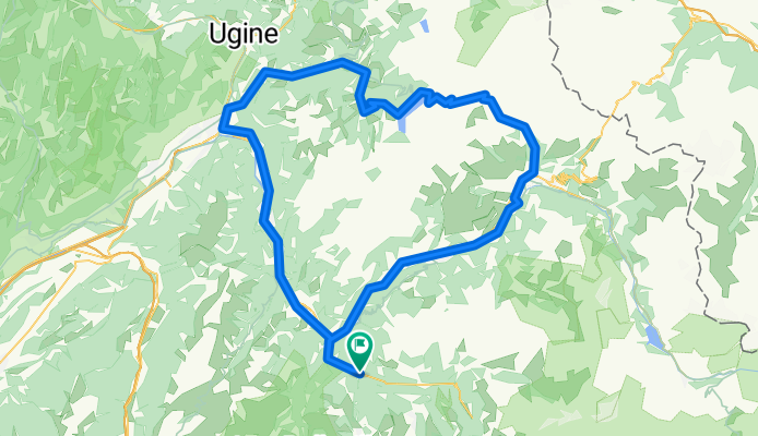
Tour_2019_-_okolo_jazera_Annecy_65km_660m
Cycling route in Thônes, Auvergne-Rhône-Alpes, France
- 64.5 km
- Distance
- 448 m
- Ascent
- 446 m
- Descent

Tour_2019_-_Colombiere_a_k_Annecy
Cycling route in Thônes, Auvergne-Rhône-Alpes, France
- 101.8 km
- Distance
- 1,701 m
- Ascent
- 1,701 m
- Descent
Tour_2019_-_Barrage_de_Rosselend_132_km_2850_m
Cycling route in Les Allues, Auvergne-Rhône-Alpes, France
- 131.2 km
- Distance
- 1,952 m
- Ascent
- 1,953 m
- Descent

D8-etapa_do_Val_thorens_80_km__2270_m
Cycling route in Les Allues, Auvergne-Rhône-Alpes, France
- 79.1 km
- Distance
- 2,006 m
- Ascent
- 2,006 m
- Descent

D7-Etapa_do_Tignes_131_km___2700_m
Cycling route in Les Allues, Auvergne-Rhône-Alpes, France
- 130.4 km
- Distance
- 1,715 m
- Ascent
- 1,715 m
- Descent

D6-Madelaine_81km_2100m
Cycling route in Les Allues, Auvergne-Rhône-Alpes, France
- 80.2 km
- Distance
- 1,829 m
- Ascent
- 1,829 m
- Descent

D6-Col_de_la_Loze_52_km_1800_m
Cycling route in Les Allues, Auvergne-Rhône-Alpes, France
- 51 km
- Distance
- 1,730 m
- Ascent
- 1,729 m
- Descent

D5-transportna_hard_137km_3740_m
Cycling route in Thônes, Auvergne-Rhône-Alpes, France
- 136 km
- Distance
- 3,104 m
- Ascent
- 3,142 m
- Descent

D5-transportna_easy_74km_990m
Cycling route in Thônes, Auvergne-Rhône-Alpes, France
- 73.6 km
- Distance
- 639 m
- Ascent
- 677 m
- Descent

D4-Semnoz_100_km_2000m
Cycling route in Thônes, Auvergne-Rhône-Alpes, France
- 99.7 km
- Distance
- 1,740 m
- Ascent
- 1,738 m
- Descent

D3-Col_des_Glieres_84_km_2100_m
Cycling route in Thônes, Auvergne-Rhône-Alpes, France
- 82.9 km
- Distance
- 1,804 m
- Ascent
- 1,805 m
- Descent

D2-Aravis_Saises_120_km__3000_m
Cycling route in Thônes, Auvergne-Rhône-Alpes, France
- 121 km
- Distance
- 2,493 m
- Ascent
- 2,493 m
- Descent