Wanderwege rund um Bad Sassendorf (5-15 km)

Wanderwege rund um Bad Sassendorf (5-15 km)

A collection of 12 cycling routes, created by Gäste-Information / Marketing Bad Sassendorf.

Overview

About this collection

This route collection contains 12 cycling routes with a total length of 96.9 km.

12
Routes
-:--
Duration
96.9 km
Distance
---
Avg. speed
409 m
Ascent
422 m
Descent

Wanderwege rund um Bad Sassendorf (5-15 km)

Routes in this collection

All 12 routes in this collection can be opened on the map or in the Bikemap App for more details, where you can adjust them in the route planner, or download them as GPX or KML file. Use them as a template for planning your own rides, or let Bikemap navigate you along them directly.

A1 - Kurz & gut (gesundes Wandern rund um Bad Sassendorf)

Cycling route in Bad Sassendorf, North Rhine-Westphalia, Germany

The approximately 8 km long hiking trail A1 starts at the BördeTherme. From there, it leads past the sports center and the Quellenhof clinic through the fields towards Heppen. Along the way, a fantastic view of the church silhouette of Soest opens up. Through the village of Heppen and the fields,…
6.9 km
Distance
25 m
Ascent
25 m
Descent

A2 - Kleine Genießerwanderung I

Cycling route in Bad Sassendorf, North Rhine-Westphalia, Germany

The approximately 5 km long route starts at the BördeTherme. From there, the path leads past the sports center towards Gabrechten and back through the fields. Under the railway underpass, it continues into the spa park, past the pond and the Brunnenhaus café back to the BördeTherme. After the hike…
4.8 km
Distance
19 m
Ascent
21 m
Descent

A3 - Wanderung nach Lohne

Cycling route in Bad Sassendorf, North Rhine-Westphalia, Germany

The approximately 7 km long hiking trail A3 starts at the town hall and leads from there over the Landwehr and Landerpfad towards Lohne to the farm "Under the Trees". It continues through Lohne past numerous venerable farms towards Schallern. Those who wish can take a short detour into the villag…
5 km
Distance
21 m
Ascent
22 m
Descent

A4 - Kleine Genießerwanderung II

Cycling route in Bad Sassendorf, North Rhine-Westphalia, Germany

The approximately 5.5 km long hiking trail A4 starts at the BördeTherme. From there, the path leads past the sports center towards Gabrechten and further towards Weslarn. At the first opportunity, the path diverges to the right from the main path into the nature reserve Rosenau. Along the Rosenau …
5.8 km
Distance
28 m
Ascent
32 m
Descent

A5 - Große Wanderung für Naturentdecker

Cycling route in Bad Sassendorf, North Rhine-Westphalia, Germany

The ten km circular route A 5 starts at the BördeTherme and heads west past the primary school and the Quellenhof clinic through the fields, with a view of the Soest church silhouette in the district of Heppen. From there, it continues north through the Sieningsen settlement into the Weslarn distr…
11.2 km
Distance
32 m
Ascent
34 m
Descent

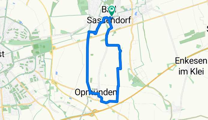
A6 - Wanderung nach Opmünden

Cycling route in Bad Sassendorf, North Rhine-Westphalia, Germany

Der ca. 10 km lange Rundweg A 6 beginnt am Rathaus Bad Sassendorf und führt in südlicher Richtung aus dem Ort heraus in die offene Landschaft mit weiten Ausblicken über die Haar und durch den kleinen Bad Sassendorfer Ortsteil Opmünden. Zurück geht es in Richtung Norden du…
9.1 km
Distance
42 m
Ascent
44 m
Descent

A8 - Kleine Wanderung für Naturentdecker

Cycling route in Bad Sassendorf, North Rhine-Westphalia, Germany

Der ca. 5 km lange Wanderweg A8 startet an der BördeTherme. Von dort führt der Weg über die Gartenstraße und „Zur Hepper Höhe“ zur Klinik Quellenhof und zum Freiherr-von-Wintzingerode-Park (Wildpark). Hier lohnt sich ein Blick hinein in den Park (s.u.). Der W…
5.3 km
Distance
29 m
Ascent
30 m
Descent

A7 - Wanderung zur alten Hansestadt Soest

Cycling route in Bad Sassendorf, North Rhine-Westphalia, Germany

The approximately 9 km long hiking trail A7 starts at the town hall. Via Bahnhofstraße, you reach the parking lot "An der Rosenau". Behind the restaurant "An der Rosenau," an idyllic path leads along the Haullenbach stream and through the residential area to Birkenweg. Passing the animal shelte…
9.1 km
Distance
52 m
Ascent
52 m
Descent

A9 - Neuengeseke und der Bierpfad

Cycling route in Bad Sassendorf, North Rhine-Westphalia, Germany

Der 15 km lange Wanderweg A9 startet am Rathaus. Von dort führt der Weg Richtung Lohne über die Goethestraße, den Rennweg und den historischen „Alten Hellweg“ (siehe A 10), durch Lohne bis zum Sudweg. Weiter führt der Weg zum Gewerbepark „Lohner Klei“,…
13.5 km
Distance
75 m
Ascent
72 m
Descent

A10 - Rund um den Flugplatz Soest/Bad Sassendorf

Cycling route in Bad Sassendorf, North Rhine-Westphalia, Germany

Der ca. 13 km lange Wanderweg startet am Rathaus. Von dort führt der Weg Richtung Lohne über die Goethestraße, den Rennweg und den historischen „Alten Hellweg“, durch Lohne bis zum Sudweg. Weiter führt der Weg zum Gewerbepark „Lohner Klei“, einem ehema…
11.1 km
Distance
45 m
Ascent
48 m
Descent

Paulas Runde I (um den Wintzingerode-Park)

Cycling route in Bad Sassendorf, North Rhine-Westphalia, Germany

6.4 km
Distance
27 m
Ascent
29 m
Descent

Paulas Runde II (durch die Woeste)

Cycling route in Bad Sassendorf, North Rhine-Westphalia, Germany

8.6 km
Distance
14 m
Ascent
13 m
Descent