
Harz
A cycling tour with 14 stages, starting in Wernigerode, Saxony-Anhalt, Germany.OverviewAbout this tour
Harz tours starting in Wernigerode
- 14
- Routes
- -:--
- Duration
- 1,486.7 km
- Distance
- ---
- Avg. speed
- 17,328 m
- Ascent
- 16,215 m
- Descent
TeamLangen-HHcreated this 5 years ago

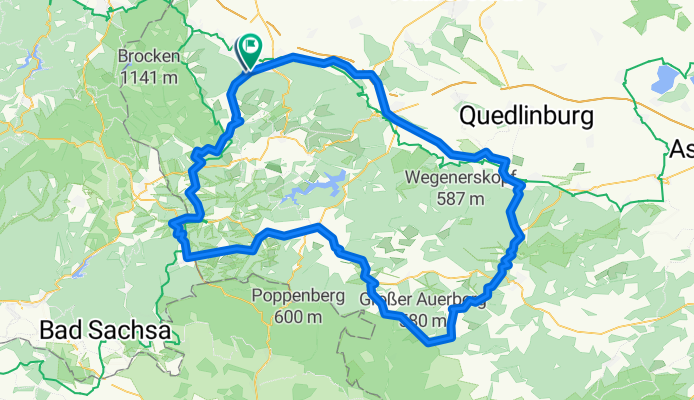
Wernigerode Harz Brocken-125km(RK)
Cycling route in Wernigerode, Saxony-Anhalt, Germany
On 19.05.2012 (Sat.) traveled by Team Langen (5 riders):
Wernigerode - Schierke, 10 km Brocken ascent (The new road is ready! Unfortunately, the last km is still not suitable for RR), Schierke - Elend - Sorge - Tanne - Benneckenstein - Rothesütte - Sophienhof - towards B81, B81 towards Hasselfelde…
- 125 km
- Distance
- 1,502 m
- Ascent
- 1,501 m
- Descent

Wernigerode HarzS-123km (RK)
Cycling route in Wernigerode, Saxony-Anhalt, Germany
Vom Team Langen geplant im Mai 2015
- 122.7 km
- Distance
- 1,153 m
- Ascent
- 1,153 m
- Descent

Wernigerode HarzS-67km (RK)
Cycling route in Wernigerode, Saxony-Anhalt, Germany
Vom Team Langen am 01.06.2014 (So. = letzter Tag) gefahrene abgekürzte Ausrollrunde.
- 66.9 km
- Distance
- 852 m
- Ascent
- 858 m
- Descent

Wernigerode HarzS-85km (RK)
Cycling route in Wernigerode, Saxony-Anhalt, Germany
Noch nicht gefahren (Vorschlag für 2009).
Weitere Infos nach der Fahrt.
- 85.1 km
- Distance
- 1,229 m
- Ascent
- 985 m
- Descent

Wernigerode HarzSO-101km (RK)
Cycling route in Wernigerode, Saxony-Anhalt, Germany
The warm-up ride from Team Langen on 09.05.2013 (113 km) was shortened to 101 km for 29.05.2014, as we are starting a bit later.
- 101.1 km
- Distance
- 1,126 m
- Ascent
- 1,126 m
- Descent

Wernigerode HarzSO-111km (Brockenrunde)
Cycling route in Wernigerode, Saxony-Anhalt, Germany
Route #305070 (johnny) largely adopted.
Ridden by Team Langen on 15.05.2010. The Brockenstraße still has the same completion status as in autumn 2009. After 4 km we turned back. Hopefully, we will progress further in May 2011. More information will follow.
- 111.3 km
- Distance
- 973 m
- Ascent
- 973 m
- Descent
Wernigerode HarzSO-123km (RK)
Cycling route in Wernigerode, Saxony-Anhalt, Germany
On 23.05.2009, ridden by Team Langen with 7 bikers.
Ride time: 4:46 = 26.32 km/h
- 123.2 km
- Distance
- 1,659 m
- Ascent
- 1,536 m
- Descent

Wernigerode HarzSO-146km (RK)
Cycling route in Wernigerode, Saxony-Anhalt, Germany
Noch nicht gefahren.
Geplant für 2015.
- 146.2 km
- Distance
- 1,137 m
- Ascent
- 1,136 m
- Descent

Wernigerode HarzSO 75 km Ausrollen (RK)
Cycling route in Wernigerode, Saxony-Anhalt, Germany
On 05.06.2011 (day 4) rolled out by Team Langen on this route. Also suitable as a warm-up ride, as there is little elevation.
Wenigerode - Benzigerode - Heimburg - Pfeifenkrug - Blankenburg - Cattenstedt - Wienrode - Treseburg - Allrode - towards Stiege - L95 to B81 - towards Wendefurth dam or Rap…
- 75.4 km
- Distance
- 776 m
- Ascent
- 776 m
- Descent

Wernigerode HarzSO-83km (RK)
Cycling route in Wernigerode, Saxony-Anhalt, Germany
Not yet ridden (suggestion for 2009)
Further info after the ride.
- 82.9 km
- Distance
- 1,150 m
- Ascent
- 1,039 m
- Descent

Wernigerode HarzSW-99km (RK)
Cycling route in Wernigerode, Saxony-Anhalt, Germany
Noch nicht gefahren (Vorschlag für 2009).
Weitere Infos nach der Fahrt.
- 98.9 km
- Distance
- 1,475 m
- Ascent
- 1,151 m
- Descent

Wernigerode HarzW-126km (RK)
Cycling route in Wernigerode, Saxony-Anhalt, Germany
Not yet ridden (suggestion for 2009).
Further info after the ride.
- 125.4 km
- Distance
- 1,866 m
- Ascent
- 1,550 m
- Descent