
CAMP - HR ALPS 2021
A cycling tour with 7 stages, starting in Annecy, Auvergne-Rhône-Alpes, France.
Overview
About this tour
This cycling tour has 7 stages and a total length of 620.1 km.
- 7
- Routes
- -:--
- Duration
- 620.1 km
- Distance
- ---
- Avg. speed
- 10,378 m
- Ascent
- 10,001 m
- Descent

created this 4 years ago
CAMP - HR ALPS 2021
Stages of this tour
All 7 stages of this tour can be opened on the map or in the Bikemap App for more details, where you can adjust them in the route planner or download them as GPX or KML file. Use them as a template for planning your own tour, or let Bikemap navigate you along them directly.

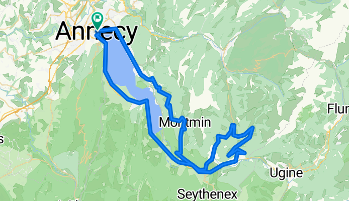
Day 2 - Col des Aravis loop return via Col de la Croix Fry
Cycling route in Annecy, Auvergne-Rhône-Alpes, France
- 142 km
- Distance
- 2,290 m
- Ascent
- 2,289 m
- Descent
Day 4 - Col de l'Epine and Col de la Forclaz
Cycling route in Annecy, Auvergne-Rhône-Alpes, France
- 82.8 km
- Distance
- 1,276 m
- Ascent
- 1,274 m
- Descent
Day 5 - Le Semnoz via Col de Leschaux
Cycling route in Annecy-le-Vieux, Auvergne-Rhône-Alpes, France
- 57.1 km
- Distance
- 1,479 m
- Ascent
- 1,479 m
- Descent
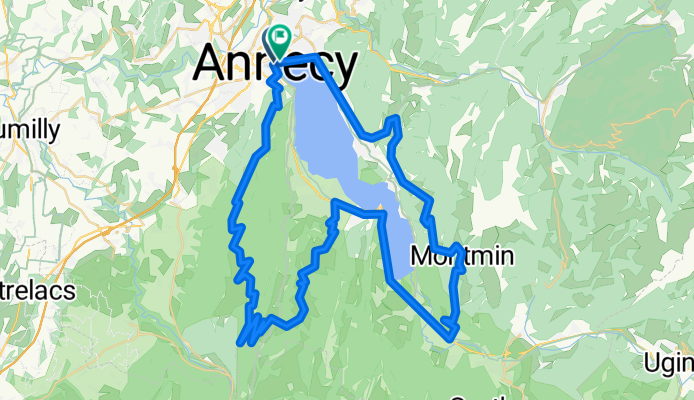
Optional Ride - Annecy-Semnoz 82kms-2200m
Cycling route in Annecy, Auvergne-Rhône-Alpes, France
- 84 km
- Distance
- 1,978 m
- Ascent
- 1,978 m
- Descent

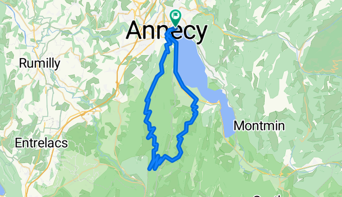
Day 1 - Welcome Ride - Annecy Loop Easy ride
Cycling route in Annecy, Auvergne-Rhône-Alpes, France
- 39.6 km
- Distance
- 182 m
- Ascent
- 182 m
- Descent
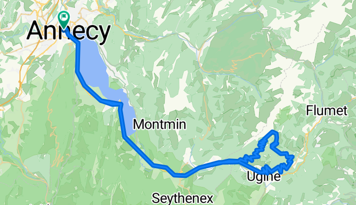
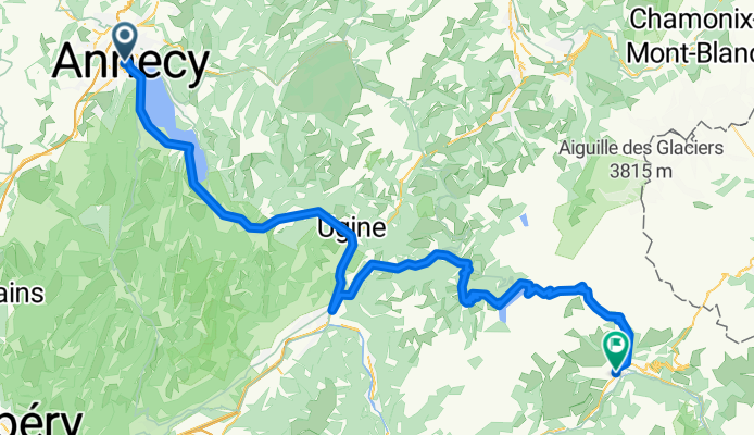
Day 3 - Option 1 - Col de l'Arpettaz
Cycling route in Annecy, Auvergne-Rhône-Alpes, France
- 106.1 km
- Distance
- 1,283 m
- Ascent
- 1,282 m
- Descent
Day 3 Option 2 - Annecy to Bourg Saint Maurice
Cycling route in Annecy, Auvergne-Rhône-Alpes, France
- 108.6 km
- Distance
- 1,890 m
- Ascent
- 1,517 m
- Descent