
Normandie 2022
A cycling tour with 10 stages, starting in Forges-les-Eaux, Normandy, France.
Overview
About this tour
Normandy Tour 2022
- 10
- Routes
- -:--
- Duration
- 526.3 km
- Distance
- ---
- Avg. speed
- 3,030 m
- Ascent
- 3,059 m
- Descent

created this 4 years ago
Normandie 2022
Stages of this tour
All 10 stages of this tour can be opened on the map or in the Bikemap App for more details, where you can adjust them in the route planner or download them as GPX or KML file. Use them as a template for planning your own tour, or let Bikemap navigate you along them directly.

Etappe 1 // Forges-les-eaux -- Petit Appeville
Cycling route in Forges-les-Eaux, Normandy, France
- 66.6 km
- Distance
- 274 m
- Ascent
- 407 m
- Descent

Etappe 3 (Rundtour): Malleville-Fecamp-Malleville (60km)
Cycling route in Cany-Barville, Normandy, France
- 60.4 km
- Distance
- 555 m
- Ascent
- 557 m
- Descent

Etappe 4 (ESM)): Malleville - St.Wandrille Rancon (57 km)
Cycling route in Cany-Barville, Normandy, France
- 56.6 km
- Distance
- 465 m
- Ascent
- 465 m
- Descent

Etappe 5: St.Wandrille Rancon -- La Bouille über Jumieges (53km)
Cycling route in Saint-Wandrille-Rançon, Normandy, France
- 51.3 km
- Distance
- 218 m
- Ascent
- 231 m
- Descent

Etappe 6 // La Bouille -- Rouen
Cycling route in Sahurs, Normandy, France
- 21.3 km
- Distance
- 60 m
- Ascent
- 59 m
- Descent

Etappe 7 // Rouen -- Saint-Aubin-lès-Elbeuf
Cycling route in Rouen, Normandy, France
- 26.9 km
- Distance
- 180 m
- Ascent
- 166 m
- Descent

Etappe 8 // Saint-Aubin-lès-Elbeuf -- Les Andelys
Cycling route in Cléon, Normandy, France
- 49.1 km
- Distance
- 115 m
- Ascent
- 128 m
- Descent

Etappe 9 // Les-Andelys -- Bazincourt (Gisors)
Cycling route in Les Andelys, Normandy, France
- 72 km
- Distance
- 321 m
- Ascent
- 217 m
- Descent
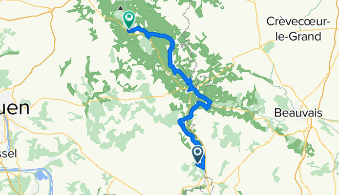
Etappe 10 // Bazincourt -- Forget-les-Eaux
Cycling route in Sérifontaine, Hauts-de-France, France
- 62.3 km
- Distance
- 555 m
- Ascent
- 530 m
- Descent

Etappe 2 Alternative Varengeville-sur-mer
Cycling route in Hautot-sur-Mer, Normandy, France
- 59.7 km
- Distance
- 287 m
- Ascent
- 299 m
- Descent