
Col after col - Pyrénées (7.6.-15.6.2022)
A collection of 11 cycling routes, created by Leander.
Overview
About this collection
This route collection contains 11 cycling routes with a total length of 673 km.
- 11
- Routes
- -:--
- Duration
- 673 km
- Distance
- ---
- Avg. speed
- 19,385 m
- Ascent
- 20,380 m
- Descent
created this 3 years ago
Col after col - Pyrénées (7.6.-15.6.2022)
Routes in this collection
All 11 routes in this collection can be opened on the map or in the Bikemap App for more details, where you can adjust them in the route planner, or download them as GPX or KML file. Use them as a template for planning your own rides, or let Bikemap navigate you along them directly.

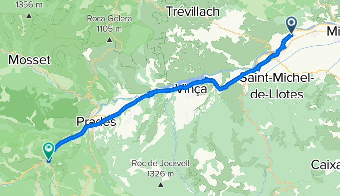
Tag 2 vor train jaune
Cycling route in Ille-sur-Têt, Occitanie, France
- 28.4 km
- Distance
- 451 m
- Ascent
- 139 m
- Descent

Tag 2 nach train jaune
Cycling route in Osséja, Occitanie, France
- 75.2 km
- Distance
- 2,439 m
- Ascent
- 3,871 m
- Descent

Tag 3 Col du Pradel
Cycling route in Quillan, Occitanie, France
- 86.6 km
- Distance
- 3,534 m
- Ascent
- 3,299 m
- Descent

Tag 4 Port de Lers, Col d'Agnès, Col de la Core
Cycling route in Tarascon-sur-Ariège, Occitanie, France
- 98 km
- Distance
- 3,646 m
- Ascent
- 3,612 m
- Descent

Tag 5 - Col de Portet d'Aspet, Col de Menté, Col de Peyresourde
Cycling route in Saint-Girons, Occitanie, France
- 106.6 km
- Distance
- 4,574 m
- Ascent
- 4,424 m
- Descent

Tag 6 - Col d'Aspin
Cycling route in Saint-Lary-Soulan, Occitanie, France
- 30.2 km
- Distance
- 1,291 m
- Ascent
- 964 m
- Descent

Tag 7 - Col du Tourmalet
Cycling route in Campan, Occitanie, France
- 53.9 km
- Distance
- 2,055 m
- Ascent
- 2,650 m
- Descent

Tag 7 - Col de Tramassel (Hautacam)
Cycling route in Pierrefitte-Nestalas, Occitanie, France
- 28.8 km
- Distance
- 1,195 m
- Ascent
- 1,193 m
- Descent

Tag 8 - Col d'Aubisque, Col de Spandelles
Cycling route in Pierrefitte-Nestalas, Occitanie, France
- 129.1 km
- Distance
- 0 m
- Ascent
- 0 m
- Descent

Tag 9 (nur Rückfahrt)
Cycling route in Pierrefitte-Nestalas, Occitanie, France
- 14.3 km
- Distance
- 83 m
- Ascent
- 202 m
- Descent