
Garmisch
A collection of 6 cycling routes, created by Wolfgang Thalmeir.OverviewAbout this collection
This route collection contains 6 cycling routes
with a total length of 234.1 km.
- 6
- Routes
- 12 h 41 min
- Duration
- 234.1 km
- Distance
- 18.5 km/h
- Avg. speed
- 1,204 m
- Ascent
- 1,207 m
- Descent
Wolfgang Thalmeircreated this 3 years ago
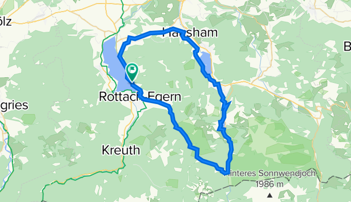
Tegernsee, Valepp, Spitzingsee, Schliersee
Cycling route in Tegernsee, Bavaria, Germany
Vermutlich nette kleine Runde. Werde sie dieses Jahr einmal Probefahren, dann kann ich mehr dazu sagen für welche Fahrradtypen sie geeignet ist.
- 47.5 km
- Distance
- 623 m
- Ascent
- 625 m
- Descent

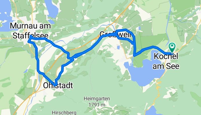
Große Moosrunde - Mit dem Rad von Kochel durch das Loisach-Moor
Cycling route in Kochel, Bavaria, Germany
In the footsteps of the 'Blue Rider' through the Kochelsee-Loisach Moor from Kochel a. See.
- 30.6 km
- Distance
- 0 m
- Ascent
- 0 m
- Descent
Große Fahrradrunde durch das Kochler Moos, Murnau und Ohlstadt
Cycling route in Kochel, Bavaria, Germany
Varied bike tour mostly on flat terrain
- 38.9 km
- Distance
- 0 m
- Ascent
- 0 m
- Descent

Rundfahrt zwischen Isar und Loisach
Cycling route in Bad Heilbrunn, Bavaria, Germany
Tour through the hilly area between the Isar and Loisach with small hamlets and villages. Very beautiful viewpoints, route over cycle paths and little-trafficked country roads.
- 34.1 km
- Distance
- 0 m
- Ascent
- 0 m
- Descent
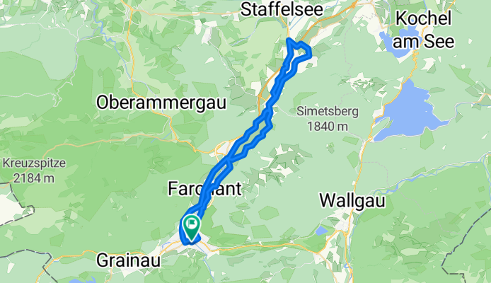
Radtour durch das Loisachtal
Cycling route in Garmisch-Partenkirchen, Bavaria, Germany
- 48.3 km
- Distance
- 155 m
- Ascent
- 156 m
- Descent

Radtour von Garmisch-Partenkirchen ins Katzental
Cycling route in Garmisch-Partenkirchen, Bavaria, Germany
- 34.7 km
- Distance
- 426 m
- Ascent
- 426 m
- Descent