
BOM.B.A. Trails
A collection of 4 cycling routes, created by Bologna Montana Bike Area.
Overview
About this collection
This route collection contains 4 cycling routes with a total length of 102.7 km.
- 4
- Routes
- -:--
- Duration
- 102.7 km
- Distance
- ---
- Avg. speed
- 3,301 m
- Ascent
- 3,285 m
- Descent
Bologna Montana Bike Area

created this 2 years ago
BOM.B.A. Trails
Routes in this collection
All 4 routes in this collection can be opened on the map or in the Bikemap App for more details, where you can adjust them in the route planner, or download them as GPX or KML file. Use them as a template for planning your own rides, or let Bikemap navigate you along them directly.


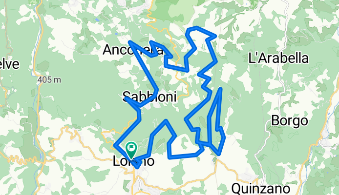
Riccio Trail
Cycling route in Loiano, Emilia-Romagna, Italy
Trail discovering stunning centuries-old chestnut groves, streams and waterfalls, evocative landscapes and... the wreck of an old car. There are challenging climbs and some spicy descents. The ride does not present extreme difficulties, but a decent riding skill and good physical preparation are re…
- 26.2 km
- Distance
- 801 m
- Ascent
- 804 m
- Descent


Zan trail
Cycling route in San Benedetto Val di Sambro, Emilia-Romagna, Italy
Giro dedicato alla scoperta dei sentieri della Val di Sambro, attraverso stupendi angoli naturali e borghi caratteristici come Qualto, Madonna dei Fornelli, Montefredente e il capoluogo, San Benedetto. Il giro, sebbene non banale, non presenta particolari difficoltà
- 23.1 km
- Distance
- 612 m
- Ascent
- 596 m
- Descent


Venere Trail
Cycling route in Monzuno, Emilia-Romagna, Italy
Giro All Mountain in the Monte Venere and Monte Galletto area. It crosses the Via degli Dei at several points and passes through characteristic mountain villages and hamlets. On clear days, it is possible to admire a beautiful panorama over the Bologna valleys, up to the highest peaks of the Tuscan…
- 31.9 km
- Distance
- 1,299 m
- Ascent
- 1,297 m
- Descent


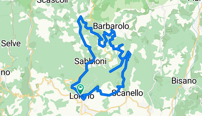
ALL-IN trail accessibile
Cycling route in Loiano, Emilia-Romagna, Italy
Un sentiero praticabile in tutte le stagioni dell’anno, caratterizzato da un tracciato semplice, senza pendenze eccessive o passaggi tecnici. ALL-IN è il primo percorso accessibile di BOM.BA e nasce dalla collaborazione con la Fondazione per lo Sport Silvia Parente. Il trail ad anello è percorribil…
- 21.6 km
- Distance
- 588 m
- Ascent
- 587 m
- Descent