
Augsburg - Venedig
A collection of 13 cycling routes, created by Bernward Müller-Prange.OverviewAbout this collection
Via Claudia Augusta Quelle Titelbild: Walkmanagement
- 13
- Routes
- 49 h 49 min
- Duration
- 756.6 km
- Distance
- 15.2 km/h
- Avg. speed
- 13,744 m
- Ascent
- 13,555 m
- Descent
Bernward Müller-Prangecreated this 1 year ago

1. Augsburg nach Schongau
Cycling route in Augsburg, Bavaria, Germany
- 91 km
- Distance
- 515 m
- Ascent
- 285 m
- Descent

3. Reutte - Imst
Cycling route in Lechaschau, Tyrol, Austria
- 67.5 km
- Distance
- 1,836 m
- Ascent
- 1,607 m
- Descent

4. Imst nach Pfunds
Cycling route in Tarrenz, Tyrol, Austria
- 59.6 km
- Distance
- 1,197 m
- Ascent
- 1,301 m
- Descent

5. Pfunds - Nauders (über den Reschenpass)
Cycling route in Pfunds, Tyrol, Austria
- 23.2 km
- Distance
- 1,090 m
- Ascent
- 662 m
- Descent

7. Meran nach Bozen
Cycling route in Schenna, Trentino-Alto Adige, Italy
- 32 km
- Distance
- 48 m
- Ascent
- 236 m
- Descent

6. Nauders nach Meran
Cycling route in Nauders, Tyrol, Austria
- 92.7 km
- Distance
- 1,021 m
- Ascent
- 2,005 m
- Descent

9. Trient nach Sovramonte
Cycling route in Trento, Trentino-Alto Adige, Italy
- 95.6 km
- Distance
- 3,199 m
- Ascent
- 2,790 m
- Descent

10. Sovramonte nach Pieve di Soligo
Cycling route in Servo, Veneto, Italy
- 79.9 km
- Distance
- 2,297 m
- Ascent
- 2,746 m
- Descent

8. Bozen nach Trient
Cycling route in Bolzano, Trentino-Alto Adige, Italy
- 66.4 km
- Distance
- 188 m
- Ascent
- 257 m
- Descent

11. Pieve di Soligo nach Quarto d'Altino
Cycling route in Pieve di Soligo, Veneto, Italy
- 65.1 km
- Distance
- 268 m
- Ascent
- 400 m
- Descent

2. Schongau - Füssen - Reutte
Cycling route in Peiting, Bavaria, Germany
- 57.7 km
- Distance
- 756 m
- Ascent
- 640 m
- Descent
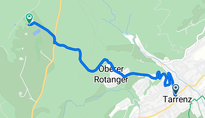
Tarrenz nach Teilwiesen 1, 6460 Imst
Cycling route in Tarrenz, Tyrol, Austria
- 3.1 km
- Distance
- 259 m
- Ascent
- 0 m
- Descent