
My saved routes
A collection of 16 cycling routes, created by laprovence.
Overview
About this collection
This collection contains all routes that were previously saved.
- 16
- Routes
- -:--
- Duration
- 737.1 km
- Distance
- ---
- Avg. speed
- 9,858 m
- Ascent
- 9,810 m
- Descent
created this 9 years ago
My saved routes
Routes in this collection
All 16 routes in this collection can be opened on the map or in the Bikemap App for more details, where you can adjust them in the route planner, or download them as GPX or KML file. Use them as a template for planning your own rides, or let Bikemap navigate you along them directly.

140728, 7. Etappe, Eguisheim-Molsheim
Cycling route in Eguisheim, Grand Est, France
- 72.9 km
- Distance
- 246 m
- Ascent
- 278 m
- Descent

Menzenschwand-Albsee-Schluchsee-Menzenschwand
Cycling route in Bernau, Baden-Wurttemberg, Germany
- 45.1 km
- Distance
- 764 m
- Ascent
- 686 m
- Descent

Von Bad Krozingen über den Kohlerhof ins Münstertal
Cycling route in Bad Krozingen, Baden-Wurttemberg, Germany
- 35.1 km
- Distance
- 561 m
- Ascent
- 561 m
- Descent
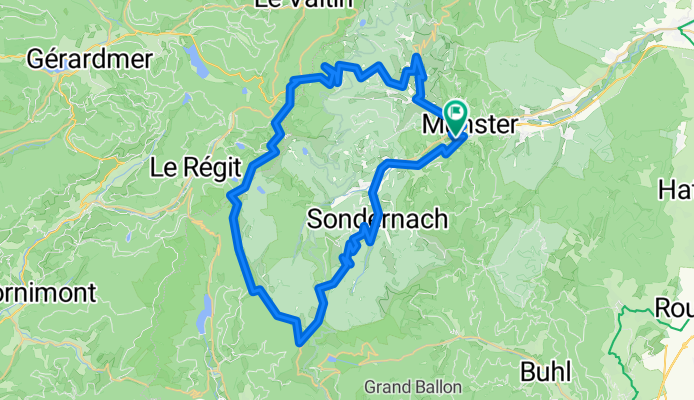
Munster - Col du Platzerwasel
Cycling route in Munster, Grand Est, France
- 58.7 km
- Distance
- 1,096 m
- Ascent
- 1,092 m
- Descent

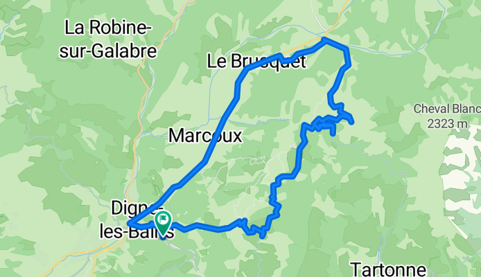
Digne-Verdaches-Digne_MT
Cycling route in Digne-les-Bains, Provence-Alpes-Côte d'Azur Region, France
- 59.7 km
- Distance
- 687 m
- Ascent
- 686 m
- Descent
Prowansja 2 - czarne ziemie
Cycling route in Digne-les-Bains, Provence-Alpes-Côte d'Azur Region, France
- 51 km
- Distance
- 819 m
- Ascent
- 821 m
- Descent

Circuit 1
Cycling route in Condorcet, Auvergne-Rhône-Alpes, France
- 60.3 km
- Distance
- 824 m
- Ascent
- 823 m
- Descent

Lac de peyssier
Cycling route in Veynes, Provence-Alpes-Côte d'Azur Region, France
- 40.9 km
- Distance
- 784 m
- Ascent
- 784 m
- Descent
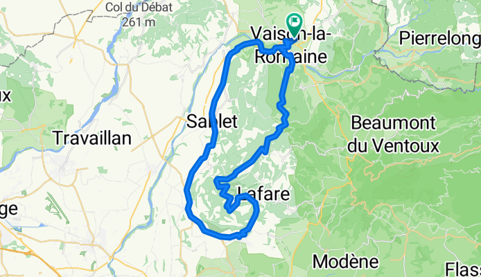
Ins Herz der Dentelles de Montmirail
Cycling route in Vaison-la-Romaine, Provence-Alpes-Côte d'Azur Region, France
- 50.3 km
- Distance
- 634 m
- Ascent
- 634 m
- Descent

Piegon
Cycling route in Vaison-la-Romaine, Provence-Alpes-Côte d'Azur Region, France
- 33.5 km
- Distance
- 402 m
- Ascent
- 403 m
- Descent

le ceans test 1
Cycling route in Laragne-Montéglin, Provence-Alpes-Côte d'Azur Region, France
- 15.7 km
- Distance
- 625 m
- Ascent
- 624 m
- Descent

tour 1
Cycling route in Laragne-Montéglin, Provence-Alpes-Côte d'Azur Region, France
- 57.1 km
- Distance
- 1,021 m
- Ascent
- 1,024 m
- Descent