
RadNETZ Donaueschingen - Geisingen
Donaueschingen–Geisingen Cycle Route
A cycling tour with 4 stages, starting in Donaueschingen, Baden-Wurttemberg, Germany.
Overview
About this tour
Smooth, simple link between Donaueschingen (home to the Danube’s source) and Geisingen in Baden‑Württemberg. It’s around 12 km, fully paved (asphalt), and mostly on tracks and quiet roads, with only gentle elevation changes (~22 m up, ~35 m down).
Easy-going and practical for everyday riders, families, and tourers. Expect open fields, small‑town views, and a relaxed pace without busy traffic. Ride it either way, use it as a quick out-and-back, or plug it into longer loops around the Baar region. Part of Baden‑Württemberg’s RadNETZ, so the routing sticks to sensible, bike-friendly ways.
Tip: surfaces are smooth, but you may meet farm vehicles on the tracks—keep an eye out and enjoy the calm ride between these two Danube‑valley towns.
- 4
- Routes
- -:--
- Duration
- 12.2 km
- Distance
- ---
- Avg. speed
- 22 m
- Ascent
- 35 m
- Descent
Donaueschingen–Geisingen Cycle Route
Stages of this tour
All 4 stages of this tour can be opened on the map or in the Bikemap App for more details, where you can adjust them in the route planner or download them as GPX or KML file. Use them as a template for planning your own tour, or let Bikemap navigate you along them directly.
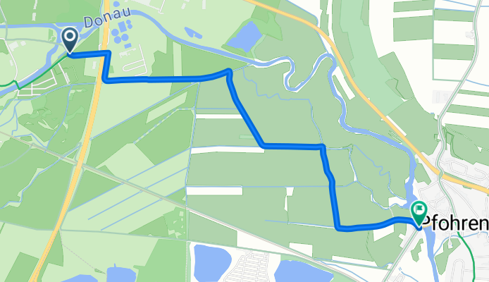
RadNETZ Donaueschingen–Geisingen: Donaueschingen–Donaueschingen
Cycling route in Donaueschingen, Baden-Wurttemberg, Germany
- 3.4 km
- Distance
- 0 m
- Ascent
- 3 m
- Descent
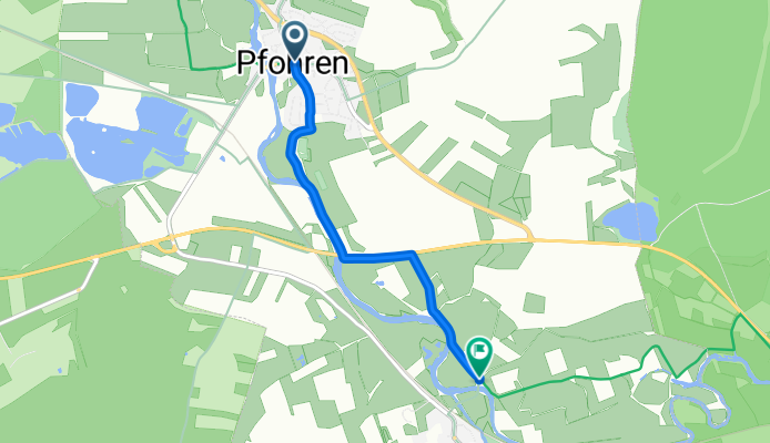
RadNETZ Donaueschingen - Geisingen
Cycling route in Donaueschingen, Baden-Wurttemberg, Germany
- 3.4 km
- Distance
- 11 m
- Ascent
- 17 m
- Descent
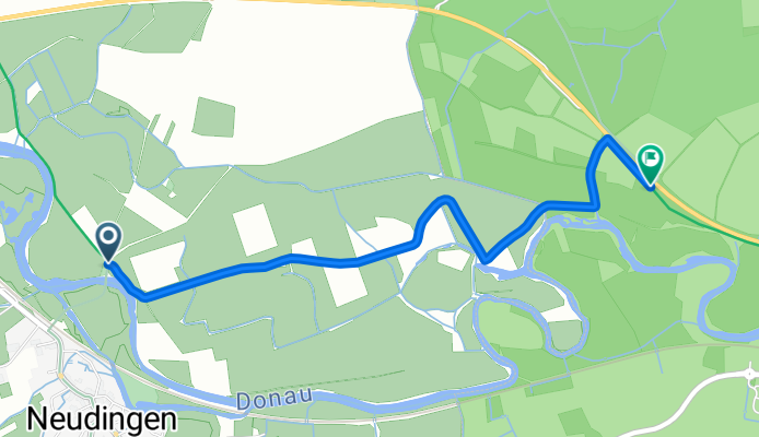
RadNETZ Donaueschingen - Geisingen: Geisingen → Geisingen
Cycling route in Geisingen, Baden-Wurttemberg, Germany
- 2.9 km
- Distance
- 0 m
- Ascent
- 3 m
- Descent
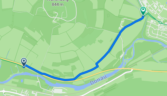
RadNETZ Donaueschingen–Geisingen: Geisingen section
Cycling route in Geisingen, Baden-Wurttemberg, Germany
- 2.6 km
- Distance
- 11 m
- Ascent
- 11 m
- Descent