
Vallée du Toulourenc
Toulourenc Valley Cycling
A collection of 3 cycling routes.
Overview
About this collection
Ride the wild, quiet side of Mont Ventoux through the Toulourenc Valley. These routes follow the river past stone villages like Mollans‑sur‑Ouvèze, Entrechaux, Brantes, Saint‑Léger‑du‑Ventoux, and Savoillans, with big Ventoux views, limestone cliffs, and lavender fields in season. It’s mostly smooth asphalt, so a road bike is ideal. Expect a mix of quiet backroads and some busier D‑roads in the gorge—keep it tight and watch for traffic in summer.
The terrain rolls and bites, with plenty of climbing (around 1,400 m across the set) and twisty descents. Best from spring to autumn; mornings are calmer if the Mistral’s up. Water and coffee stops are in the villages, but there’s not much between them—top up when you can.
Easy links to Malaucène and Ventoux’s northern approaches if you want to go bigger. For a lighter day, keep it lower in the valley and trace the river out-and-back for views without the big passes.
- 3
- Routes
- -:--
- Duration
- 49 km
- Distance
- ---
- Avg. speed
- 1,395 m
- Ascent
- 1,268 m
- Descent
Toulourenc Valley Cycling
Routes in this collection
All 3 routes in this collection can be opened on the map or in the Bikemap App for more details, where you can adjust them in the route planner, or download them as GPX or KML file. Use them as a template for planning your own rides, or let Bikemap navigate you along them directly.
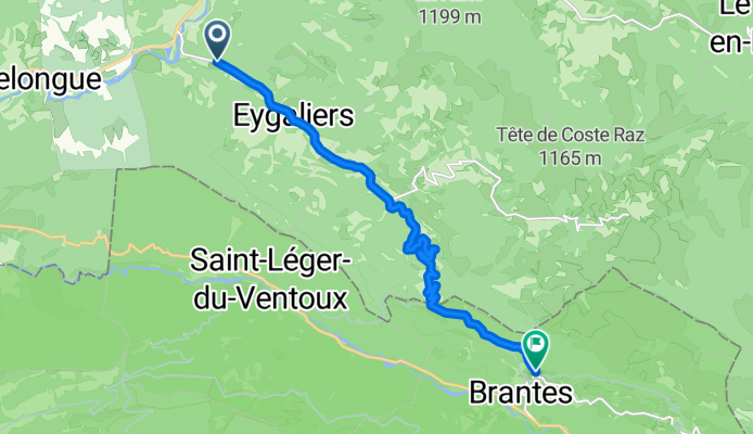
Vallée du Toulourenc: Malaucène to Buis-les-Baronnies (variante)
Cycling route in Malaucène, Provence-Alpes-Côte d'Azur Region, France
- 7.8 km
- Distance
- 124 m
- Ascent
- 63 m
- Descent
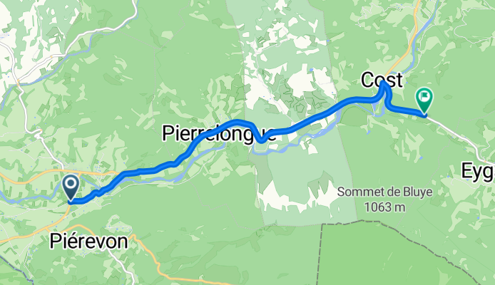
Vallée du Toulourenc (variante)
Cycling route in Buis-les-Baronnies, Auvergne-Rhône-Alpes, France
- 11.6 km
- Distance
- 496 m
- Ascent
- 232 m
- Descent

Malaucène to Buis-les-Baronnies via Vallée du Toulourenc
Cycling route in Malaucène, Provence-Alpes-Côte d'Azur Region, France
- 29.6 km
- Distance
- 775 m
- Ascent
- 973 m
- Descent