
Cucumber Bike Route
Spreewald Cucumber Cycle Route (Gurkenradweg)
A collection of 5 cycling routes.
Overview
About this collection
A flat, well-signed loop network around the Spreewald Biosphere Reserve in Brandenburg, Germany. Expect long stretches of smooth asphalt through forests, meadows, and along quiet canals, with bits of gravel and the odd cobbled section. The full circuit is about 260 km, but it’s easy to split into day rides between towns like Lübben, Lübbenau, Burg, and Cottbus. Highlights: shady pine woods, wooden bridges, pickle tastings, and the lagoon-like waterways that make Spreewald famous. Riding is mostly on low-traffic roads, paths, and farm tracks; a few short busy links appear near towns. It’s practically flat, so perfect for touring bikes, families, and relaxed cruising. Best time is April–October; summer weekends get lively around the boat harbors. Trains make it simple to hop on/off and tailor your stages. Just follow the little cucumber signs, roll easy, and enjoy frequent cafés, farm shops, and beer gardens along the way.
- 5
- Routes
- -:--
- Duration
- 264.4 km
- Distance
- ---
- Avg. speed
- 653 m
- Ascent
- 651 m
- Descent
Spreewald Cucumber Cycle Route (Gurkenradweg)
Routes in this collection
All 5 routes in this collection can be opened on the map or in the Bikemap App for more details, where you can adjust them in the route planner, or download them as GPX or KML file. Use them as a template for planning your own rides, or let Bikemap navigate you along them directly.

Gurkenradweg (Nord- und Ostring)
Cycling route in Münchehofe, Brandenburg, Germany
- 98.7 km
- Distance
- 296 m
- Ascent
- 264 m
- Descent
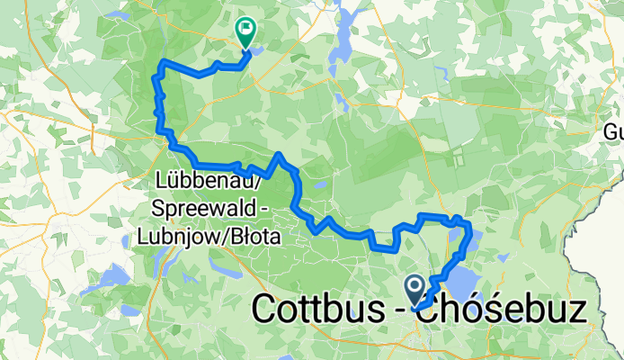
Gurkenradweg (Nord- und Ostring)
Cycling route in Cottbus, Brandenburg, Germany
- 100.7 km
- Distance
- 173 m
- Ascent
- 193 m
- Descent

Schlepzig – Münchehofe (Gurkenradweg Nord-/Ostring)
Cycling route in Schlepzig, Brandenburg, Germany
- 21.9 km
- Distance
- 86 m
- Ascent
- 95 m
- Descent

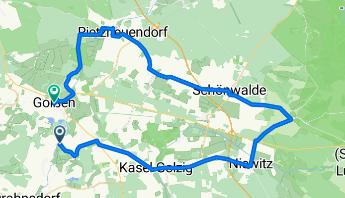
Gurkenradweg (Westring)
Cycling route in Golßen, Brandenburg, Germany
- 3 km
- Distance
- 4 m
- Ascent
- 0 m
- Descent
Gurkenradweg (Westring)
Cycling route in Golßen, Brandenburg, Germany
- 40.2 km
- Distance
- 95 m
- Ascent
- 98 m
- Descent