
Empire State Trail (super, bike)
Empire State Trail: Buffalo to Green Island
A collection of 4 cycling routes.
Overview
About this collection
Ride across upstate New York on the Empire State Trail from Buffalo to Green Island (Albany area). It’s roughly 580 km / 360 miles, mostly paved and largely traffic‑free, following the historic Erie Canal and the Mohawk River. Expect long, flat miles with canal locks, lift bridges, and easy cruising between classic canal towns.
Highlights along the way: Tonawanda and Lockport’s iconic locks, Rochester’s riverfront, the canal villages near Syracuse, Rome and Utica in the Mohawk Valley, Little Falls’ gorge, Schenectady’s Stockade, and the finish near Cohoes/Green Island. Services are frequent—cafés, bike shops, and water in most towns—so you can tour end‑to‑end or hop on for day rides.
Surface is mostly smooth asphalt with very short connectors on quiet roads through villages. Wayfinding is solid with consistent EST signage. 28 mm tires or wider are perfect. Best season is spring through fall; summers are lively with canal traffic and festivals.
Getting around is easy: Amtrak parallels much of the route (Buffalo, Rochester, Syracuse, Utica, Schenectady/Albany), so point‑to‑point rides are simple. Plan for 5–7 days for the full crossing, or pick a favorite stretch—Rochester to Lyons, Utica to Little Falls, or Schenectady to Green Island—for a relaxed day out.
- 4
- Routes
- -:--
- Duration
- 31.6 km
- Distance
- ---
- Avg. speed
- 114 m
- Ascent
- 115 m
- Descent
Empire State Trail: Buffalo to Green Island
Routes in this collection
All 4 routes in this collection can be opened on the map or in the Bikemap App for more details, where you can adjust them in the route planner, or download them as GPX or KML file. Use them as a template for planning your own rides, or let Bikemap navigate you along them directly.
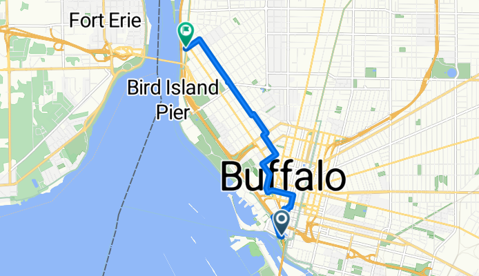
Empire State Trail: Buffalo segment
Cycling route in Buffalo, New York, United States
- 5.4 km
- Distance
- 56 m
- Ascent
- 41 m
- Descent

Empire State Trail: Kenmore to Buffalo
Cycling route in Kenmore, New York, United States
- 4.8 km
- Distance
- 0 m
- Ascent
- 17 m
- Descent
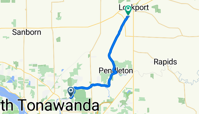
Empire State Trail: North Tonawanda to South Lockport
Cycling route in North Tonawanda, New York, United States
- 19.2 km
- Distance
- 44 m
- Ascent
- 43 m
- Descent

Empire State Trail: South Lockport to Lockport
Cycling route in South Lockport, New York, United States
- 2.3 km
- Distance
- 14 m
- Ascent
- 13 m
- Descent