
Alpine Panorama Route
Alpine Panorama Route (Switzerland)
A collection of 18 cycling routes.
Overview
About this collection
Big views, bigger climbs. The Alpine Panorama Route stitches together quiet backroads, bike paths, and a few busier connectors across the Swiss pre‑Alps. It’s roughly 475 km with over 12,000 m of ascent, so expect steady ups, swoopy descents, and postcard moments around every bend.
You’ll cruise past lakes, green hills, and classic villages with the Alps on the horizon. Surfaces are mostly smooth asphalt, with short bits of gravel, cobbles, and the odd wooden bridge—rideable on a touring bike or endurance road bike. Prefer all‑paved? You can usually detour easily.
Plan it as a multi‑day trip: a relaxed week if you’re fit, longer if you want extra coffee stops and viewpoints. Wayfinding is simple—follow the Route 4 signs—and there are frequent train links if you want to trim a stage or bail when the legs say no.
Best from late spring to autumn. Bring layers for mountain weather and good brakes for the long descents. If you like long days, quiet valleys, and big‑sky panoramas, this one’s a keeper.
- 18
- Routes
- -:--
- Duration
- 476.1 km
- Distance
- ---
- Avg. speed
- 12,617 m
- Ascent
- 12,773 m
- Descent
Alpine Panorama Route (Switzerland)
Routes in this collection
All 18 routes in this collection can be opened on the map or in the Bikemap App for more details, where you can adjust them in the route planner, or download them as GPX or KML file. Use them as a template for planning your own rides, or let Bikemap navigate you along them directly.

Alpenpanorama-Route - Etappe 2
Cycling route in Gonten, Appenzell Innerrhoden, Switzerland
- 67.5 km
- Distance
- 1,358 m
- Ascent
- 928 m
- Descent

Alpenpanorama-Route - Etappe 2
Cycling route in Appenzell, Appenzell Innerrhoden, Switzerland
- 5 km
- Distance
- 3 m
- Ascent
- 125 m
- Descent

Alpenpanorama-Route: Teufen AR to Appenzell
Cycling route in Teufen AR, Canton of Appenzell Ausserrhoden, Switzerland
- 13.5 km
- Distance
- 297 m
- Ascent
- 217 m
- Descent

Alpenpanorama-Route: Speicher – Teufen AR
Cycling route in Speicher, Canton of Appenzell Ausserrhoden, Switzerland
- 2 km
- Distance
- 67 m
- Ascent
- 10 m
- Descent

Alpenpanorama-Route: Trogen - Sankt Margrethen
Cycling route in Trogen, Canton of Appenzell Ausserrhoden, Switzerland
- 30.4 km
- Distance
- 699 m
- Ascent
- 1,204 m
- Descent

Alpenpanorama-Route - Etappe 3
Cycling route in Glarus, Canton of Glarus, Switzerland
- 64.2 km
- Distance
- 2,320 m
- Ascent
- 2,324 m
- Descent

Alpenpanorama-Route - Etappe 3
Cycling route in Altdorf, Canton of Uri, Switzerland
- 4.1 km
- Distance
- 0 m
- Ascent
- 33 m
- Descent

Alpenpanorama-Route: Bauen–Alpnach
Cycling route in Bauen, Canton of Uri, Switzerland
- 59.1 km
- Distance
- 1,805 m
- Ascent
- 1,864 m
- Descent
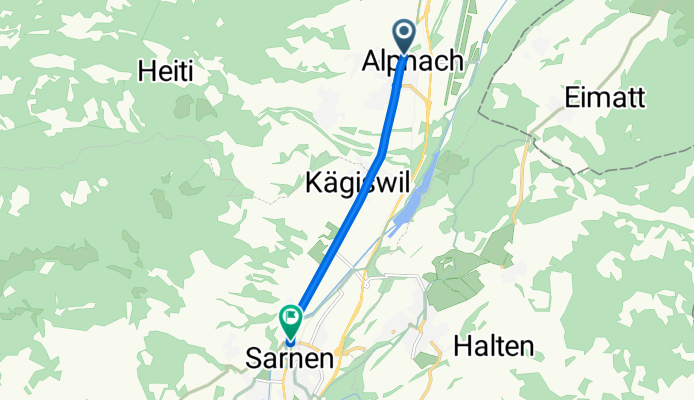
Alpenpanorama-Route: Alpnach–Sarnen
Cycling route in Alpnach, Canton of Obwalden, Switzerland
- 5.4 km
- Distance
- 37 m
- Ascent
- 31 m
- Descent

Alpenpanorama-Route: Sachseln–Flühli
Cycling route in Sachseln, Canton of Obwalden, Switzerland
- 29.2 km
- Distance
- 1,375 m
- Ascent
- 743 m
- Descent

Alpenpanorama-Route - Etappe 5
Cycling route in Thun, Canton of Bern, Switzerland
- 51.2 km
- Distance
- 968 m
- Ascent
- 1,545 m
- Descent

Alpenpanorama-Route: Blumenstein to Thun
Cycling route in Blumenstein, Canton of Bern, Switzerland
- 10.6 km
- Distance
- 130 m
- Ascent
- 45 m
- Descent