
Hohenzollern Trail
Hohenzollern Cycle Routes
A collection of 5 cycling routes.
Overview
About this collection
Ride the Hohenzollern heartland in Baden‑Württemberg, Germany. These routes roam the Swabian Alb around the famous Burg Hohenzollern, mixing quiet country roads, farm tracks, cycleways, and plenty of gravel. There’s serious climbing in places, so bring low gears and enjoy the views on the way up.
Best on a gravel or sturdy touring bike. Expect mostly asphalt with sections of compact and loose gravel, the odd cobbled or paving‑stone stretch, and a few short links on busier roads. Some town centers are pedestrian zones—roll slow and be courteous.
Highlights: forested ridges, limestone hills, wide views toward the castle, and easy coffee-and-bakery stops in small towns. Distances vary by segment, so you can pick a quick spin or stack a few for a bigger day.
Logistics are easy: start anywhere, and use regional trains to hop on/off along the way. Pack lights for shaded bits, top up water when you can, and be ready for changing weather on the Alb plateau.
- 5
- Routes
- -:--
- Duration
- 183.1 km
- Distance
- ---
- Avg. speed
- 2,793 m
- Ascent
- 3,038 m
- Descent
Hohenzollern Cycle Routes
Routes in this collection
All 5 routes in this collection can be opened on the map or in the Bikemap App for more details, where you can adjust them in the route planner, or download them as GPX or KML file. Use them as a template for planning your own rides, or let Bikemap navigate you along them directly.

Hohenzollern-Weg: Rottenburg–Tübingen
Cycling route in Rottenburg, Baden-Wurttemberg, Germany
- 12.6 km
- Distance
- 140 m
- Ascent
- 261 m
- Descent

Hohenzollern-Weg: Rottenburg – Wurmlingen (Tuttlingen)
Cycling route in Rottenburg, Baden-Wurttemberg, Germany
- 87.3 km
- Distance
- 1,494 m
- Ascent
- 1,095 m
- Descent

Hohenzollern-Weg: Wurmlingen–Tuttlingen
Cycling route in Wurmlingen, Baden-Wurttemberg, Germany
- 7.4 km
- Distance
- 64 m
- Ascent
- 140 m
- Descent
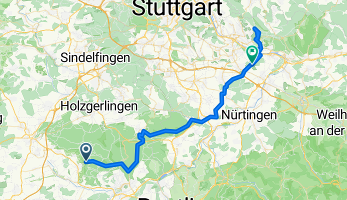
Hohenzollern-Weg: Tübingen – Denkendorf
Cycling route in Tübingen, Baden-Wurttemberg, Germany
- 65.6 km
- Distance
- 998 m
- Ascent
- 1,211 m
- Descent

Hohenzollern-Weg Abschnitt Großheppach - Esslingen
Cycling route in Weinstadt-Endersbach, Baden-Wurttemberg, Germany
- 10.1 km
- Distance
- 98 m
- Ascent
- 332 m
- Descent