
Telegraphen Cycle Route Berlin - Koblenz
Berlin–Koblenz Telegraph Cycle Route
A collection of 10 cycling routes.
Overview
About this collection
Ride from Berlin to Koblenz along the historic telegraph line. This collection links a mostly paved route with plenty of quiet roads, farm tracks, and bike paths, plus some gravel and the odd stretch of cobbles. Expect a mix of open countryside, villages, and river sections, then a grand finish in Koblenz where the Rhine and Moselle meet at the Deutsches Eck.
Terrain is mostly flat to gently rolling, with a few livelier bumps as you get closer to the Rhine. It’s very doable on a touring or gravel bike; wider tires make the unpaved bits more fun. You’ll also find occasional busier road sections—ride defensively and use lights if you’re starting early or finishing late.
The theme here is history: the route echoes the 19th‑century optical telegraph that once linked Berlin and Koblenz. Ride it end‑to‑end or break it into stages—both directions work fine. Pack snacks, charge your phone, and enjoy an east‑to‑west cross‑country ride with a cool story behind it.
- 10
- Routes
- -:--
- Duration
- 212.3 km
- Distance
- ---
- Avg. speed
- 840 m
- Ascent
- 840 m
- Descent
Berlin–Koblenz Telegraph Cycle Route
Routes in this collection
All 10 routes in this collection can be opened on the map or in the Bikemap App for more details, where you can adjust them in the route planner, or download them as GPX or KML file. Use them as a template for planning your own rides, or let Bikemap navigate you along them directly.

Telegraphenradweg: Hedeper – Roklum
Cycling route in Hedeper, Lower Saxony, Germany
- 5.6 km
- Distance
- 75 m
- Ascent
- 58 m
- Descent

Telegraphenradweg (Abschnitt Bördekreis)
Cycling route in Roklum, Lower Saxony, Germany
- 41.2 km
- Distance
- 192 m
- Ascent
- 161 m
- Descent

Telegraphenradweg: Oschersleben – Diesdorf
Cycling route in Oschersleben, Saxony-Anhalt, Germany
- 37.7 km
- Distance
- 168 m
- Ascent
- 205 m
- Descent
Telegraphenradweg (Abschnitt Sachsen-Anhalt)
Cycling route in Burg bei Magdeburg, Saxony-Anhalt, Germany
- 9.3 km
- Distance
- 16 m
- Ascent
- 6 m
- Descent

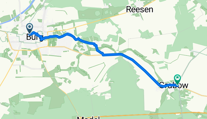
Telegraphenradweg: Burg bei Magdeburg – Tucheim
Cycling route in Burg bei Magdeburg, Saxony-Anhalt, Germany
- 21.6 km
- Distance
- 60 m
- Ascent
- 72 m
- Descent

Telegraphenradweg Tucheim – Ziesar
Cycling route in Tucheim, Saxony-Anhalt, Germany
- 12.8 km
- Distance
- 22 m
- Ascent
- 14 m
- Descent

Telegraphenradweg: Brandenburg – Ziesar
Cycling route in Brandenburg, Brandenburg, Germany
- 30.5 km
- Distance
- 100 m
- Ascent
- 118 m
- Descent

Telegraphenradweg: Groß Kreutz – Brandenburg an der Havel
Cycling route in Groß Kreutz, Brandenburg, Germany
- 11.9 km
- Distance
- 4 m
- Ascent
- 6 m
- Descent

Telegraphenradweg (Abschnitt Brandenburg)
Cycling route in Groß Kreutz, Brandenburg, Germany
- 11.1 km
- Distance
- 62 m
- Ascent
- 58 m
- Descent

Telegraphenradweg: Groß Kreutz – Werder
Cycling route in Groß Kreutz, Brandenburg, Germany
- 30.6 km
- Distance
- 141 m
- Ascent
- 141 m
- Descent